
File:AncientEgyptJamesRennell01.jpg

預覽大小:541 × 599 像素。 其他解析度:217 × 240 像素 | 433 × 480 像素 | 693 × 768 像素 | 924 × 1,024 像素 | 1,548 × 1,715 像素。
原始檔案 (1,548 × 1,715 像素,檔案大小:384 KB,MIME 類型:image/jpeg)
摘要
| 描述 |
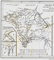
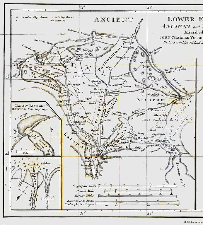
English: Map of ancient Egypt created by James Rennell as an insert for his book "The geographical system of Herodotus examined and explained" (published 1800 and 1830). This map shows Rennell's understanding of the geography of Egypt's Nile delta during the Greek Classical period (510 BC - 323 BC) based on the writings of Herodotus (484 BC - 425 BC). |
| 日期 | |
| 來源 | Book "The geographical system of Herodotus examined and explained", by James Rennell (published 1800 and 1830). |
| 作者 | Carl Drews scanned the map and enhanced the color contrast. |
授權條款
|
本作品在其來源國以及其他著作權期限是作者逝世後100年或以下的國家與地區屬於公有領域。 | |
| 此作品無已知的著作權限制,亦不受所有相關和鄰接的權利限制。 | |
檔案歷史
點選日期/時間以檢視該時間的檔案版本。
| 日期/時間 | 縮圖 | 尺寸 | 使用者 | 備註 | |
|---|---|---|---|---|---|
| 目前 | 2010年8月12日 (四) 19:23 | | 1,548 × 1,715(384 KB) | CarlDrews~commonswiki | {{Information |Description={{en|1=Map of ancient Egypt created by James Rennell as an insert for his book "The geographical system of Herodotus examined and explained" (published 1800 and 1830). This map shows Rennell's understanding of the geography of E |
檔案用途
下列頁面有用到此檔案:
全域檔案使用狀況
以下其他 wiki 使用了這個檔案:
- ar.wikipedia.org 的使用狀況
- bg.wikipedia.org 的使用狀況
- de.wikipedia.org 的使用狀況
- el.wikipedia.org 的使用狀況
- en.wikipedia.org 的使用狀況
- es.wikipedia.org 的使用狀況
- fr.wikipedia.org 的使用狀況
- he.wikipedia.org 的使用狀況
- ja.wikipedia.org 的使用狀況
- ja.wikibooks.org 的使用狀況
- nl.wikipedia.org 的使用狀況
- sl.wikipedia.org 的使用狀況
- uk.wikipedia.org 的使用狀況