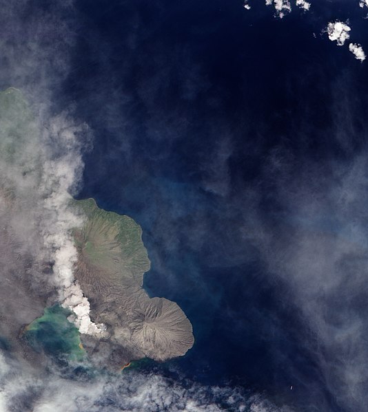
File:Ash Plume from Tavurvur, Papua New Guinea.jpg

預覽大小:534 × 599 像素。 其他解析度:214 × 240 像素 | 428 × 480 像素 | 685 × 768 像素 | 1,183 × 1,327 像素。
原始檔案 (1,183 × 1,327 像素,檔案大小:241 KB,MIME 類型:image/jpeg)
檔案歷史
點選日期/時間以檢視該時間的檔案版本。
| 日期/時間 | 縮圖 | 尺寸 | 使用者 | 備註 | |
|---|---|---|---|---|---|
| 目前 | 2009年12月8日 (二) 13:04 |  | 1,183 × 1,327(241 KB) | Originalwana | {{Information |Description={{en|1=A 1994 eruption which buried Rabaul involved the currently active Tavurvur Cone as well as Vulcan Cone, located across Blanche Bay to the south-west (not pictured). The city of Rabaul is located on the peninsula acros |
檔案用途
下列頁面有用到此檔案:
全域檔案使用狀況
以下其他 wiki 使用了這個檔案:
- br.wikipedia.org 的使用狀況
- en.wikipedia.org 的使用狀況
- fa.wikipedia.org 的使用狀況
- hu.wikipedia.org 的使用狀況
- id.wikipedia.org 的使用狀況
- it.wikipedia.org 的使用狀況
- ja.wikipedia.org 的使用狀況
- ko.wikipedia.org 的使用狀況
- pt.wikipedia.org 的使用狀況
- uk.wikipedia.org 的使用狀況


