
File:BG 14 vek.png
預覽大小:730 × 599 像素。 其他解析度:292 × 240 像素 | 585 × 480 像素 | 888 × 729 像素。
原始檔案 (888 × 729 像素,檔案大小:491 KB,MIME 類型:image/png)
摘要
| 描述 |
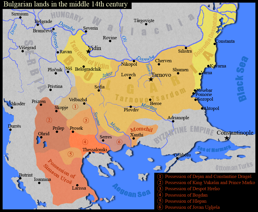
English: Тhe Bulgarian lands in the middle of the 14th century.
Български: Българските земи в средата на 14 век.
Based on map "Феодална разпокъсаност на България и падането и под турска власт (1280-1396)" in the atlas "Атлас История на България за средните училища", "Картография", София, 1990 г., стр. 8 |
| 日期 | |
| 來源 | 自己的作品 |
| 作者 | Kandi |
授權條款
| 我,此作品的版權所有人,釋出此作品至公共領域。此授權條款在全世界均適用。 這可能在某些國家不合法,如果是的話: 我授予任何人有權利使用此作品於任何用途,除受法律約束外,不受任何限制。 |

|
File:Bulgarian lands 1350 vek.svg是本檔案的向量版本。 如果品質不低,就應該優先使用該檔案,而非PNG檔案。
File:BG 14 vek.png → File:Bulgarian lands 1350 vek.svg
更多資訊請參閱Help:SVG/zh。 |
 |
檔案歷史
點選日期/時間以檢視該時間的檔案版本。
| 日期/時間 | 縮圖 | 尺寸 | 使用者 | 備註 | |
|---|---|---|---|---|---|
| 目前 | 2011年9月2日 (五) 17:11 | | 888 × 729(491 KB) | Kandi | true map |
| 2011年9月2日 (五) 16:24 |  | 730 × 599(571 KB) | Spiridon Ion Cepleanu | Names, scales and states since Codex Parisinus latinus and genovese maritime maps and descriptions in : Ph. Lauer, Catalogue des manuscrits latins, pp.95-6, d'après la Bibliothèque Nationale Lat. 1623, IX-X, Paris, 1940. And Wallachia are also a heir st | |
| 2009年1月24日 (六) 08:49 |  | 888 × 729(442 KB) | Kandi | {{Information |Description=Тhe Bulgarian lands in the middle of the 14th century |Source=self-made |Date=24.01.2009 |Author=Kandi |Permission= |other_versions= }} Category:Maps of the history of Bulgaria Category:Maps showing 14th-century history |
檔案用途
下列頁面有用到此檔案:
全域檔案使用狀況
以下其他 wiki 使用了這個檔案:
- als.wikipedia.org 的使用狀況
- bg.wikipedia.org 的使用狀況
- en.wikipedia.org 的使用狀況
- nl.wikipedia.org 的使用狀況
- pl.wikipedia.org 的使用狀況
- ru.wikipedia.org 的使用狀況
- sr.wikipedia.org 的使用狀況
- uk.wikipedia.org 的使用狀況