
File:Brecqhou from the air.JPG
預覽大小:800 × 510 像素。 其他解析度:320 × 204 像素 | 640 × 408 像素 | 1,024 × 653 像素 | 1,280 × 816 像素 | 2,560 × 1,631 像素 | 3,978 × 2,535 像素。
原始檔案 (3,978 × 2,535 像素,檔案大小:4.31 MB,MIME 類型:image/jpeg)
摘要
| 描述 |
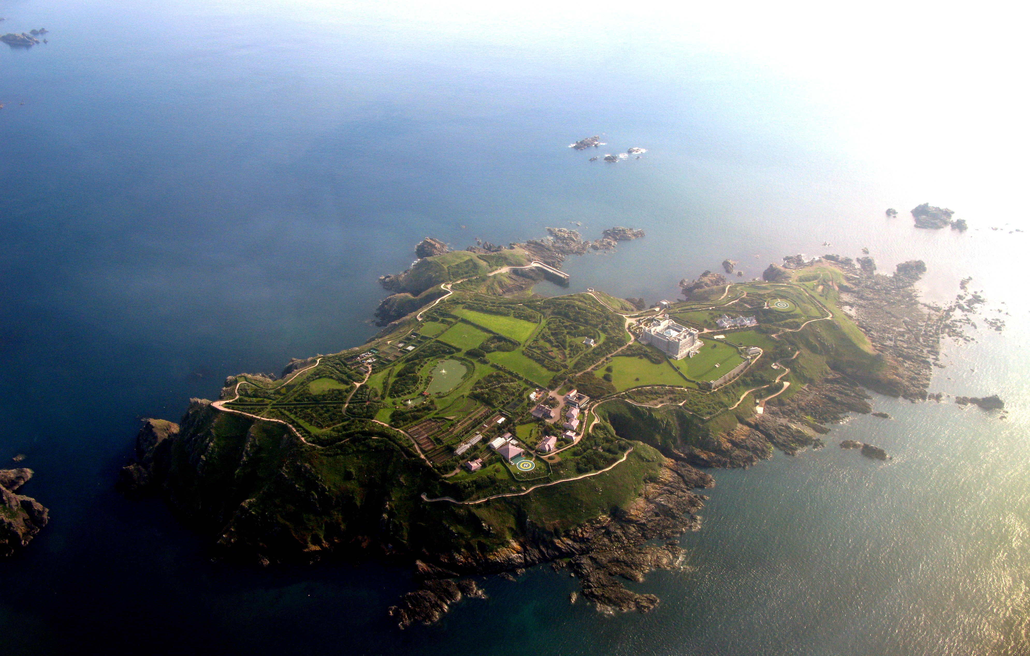
English: Brecqhou island from the air
Español: La isla de Brecqhou desde el aire
Français : Vue aérienne de l'île de Brecqhou |
| 日期 | |
| 來源 | 自己的作品 |
| 作者 | Diegourdiales |
| 拍攝地點 | | 位於此地的本圖片與其他圖片: OpenStreetMap |
|---|
授權條款
Diegourdiales,此作品的版權所有人,決定用以下授權條款發佈本作品:
此檔案採用創用CC 姓名標示 3.0 未在地化版本授權條款。
姓名標示: Diegourdiales
- 您可以自由:
- 分享 – 複製、發佈和傳播本作品
- 重新修改 – 創作演繹作品
- 惟需遵照下列條件:
- 姓名標示 – 您必須指名出正確的製作者,和提供授權條款的連結,以及表示是否有對內容上做出變更。您可以用任何合理的方式來行動,但不得以任何方式表明授權條款是對您許可或是由您所使用。
原始上傳日誌
| date/time | username | resolution | size | edit summary |
|---|---|---|---|---|
| 2009-05-23T14:45:00Z | User:Diegourdiales | 3978×2535 | 4.31Gb | {{Information |Description={{en|1=Herm island from the air}} {{es|1=La isla de Herm desde el aire}} {{fr|1=Vue aérienne de l'île d'Herm}} |Source=Own work by uploader |Author=[[User:Diegourdiales|Diegourdiales]] |Date=2009-05-14 |Permission= |other_vers |
檔案歷史
點選日期/時間以檢視該時間的檔案版本。
| 日期/時間 | 縮圖 | 尺寸 | 使用者 | 備註 | |
|---|---|---|---|---|---|
| 目前 | 2009年7月10日 (五) 12:47 | | 3,978 × 2,535(4.31 MB) | BetacommandBot | move approved by: User:Telim tor This image was moved from File:Herm from the air.JPG == Summary == {{Information |Description={{en|1=Brecqhou island from the air}} {{es|1=La isla de Brecqhou desde el aire}} {{fr|1=Vue aérienne de l'île de B |
檔案用途
下列頁面有用到此檔案:
全域檔案使用狀況
以下其他 wiki 使用了這個檔案:
- ceb.wikipedia.org 的使用狀況
- cy.wikipedia.org 的使用狀況
- de.wikipedia.org 的使用狀況
- en.wikipedia.org 的使用狀況
- eo.wikipedia.org 的使用狀況
- es.wikipedia.org 的使用狀況
- fr.wikipedia.org 的使用狀況
- gl.wikipedia.org 的使用狀況
- he.wikipedia.org 的使用狀況
- he.wikivoyage.org 的使用狀況
- ja.wikipedia.org 的使用狀況
- nn.wikipedia.org 的使用狀況
- no.wikipedia.org 的使用狀況
- pl.wikipedia.org 的使用狀況
- pt.wikipedia.org 的使用狀況
- ru.wikipedia.org 的使用狀況
- simple.wikipedia.org 的使用狀況
- sr.wikipedia.org 的使用狀況
- sv.wikipedia.org 的使用狀況
- uk.wikipedia.org 的使用狀況
- vi.wikipedia.org 的使用狀況
- www.wikidata.org 的使用狀況