
File:Central America volcanic belt.jpg

預覽大小:800 × 562 像素。 其他解析度:320 × 225 像素 | 640 × 449 像素 | 1,024 × 719 像素 | 1,280 × 899 像素 | 2,560 × 1,798 像素 | 4,081 × 2,866 像素。
原始檔案 (4,081 × 2,866 像素,檔案大小:3.02 MB,MIME 類型:image/jpeg)
| 描述 |
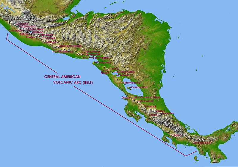
English: Central America in SRTM Shaded Relief and Colored Height |
| 日期 | (UTC) |
| 來源 | |
| 作者 |
|
| 這是一張修飾過的圖片,即本圖片是用軟體修改過後的版本,修改的方式或內容有:Captions of volcanoes in Central America Volcanic Arc。原版圖片來源:Topographic map of Central America.jpg。修改者:Judygreenberg。
|
| 本作品由NASA創作,屬於公有領域。根據NASA的版權政策:“NASA的創作除非另有聲明否則不受版權保護。”(參見:Template:PD-USGov/zh,NASA版權政策或JPL圖像使用政策) | ||
 |
警告:
|
原始上傳日誌
This image is a derivative work of the following images:
- File:Topographic_map_of_Central_America.jpg licensed with PD-USGov-NASA
- 2010-01-08T15:57:36Z Minor edit 9600x9000 (8603290 Bytes) {{Information |Description={{en|Central America in SRTM Shaded Relief and Colored Height}} |Source=http://photojournal.jpl.nasa.gov/catalog/PIA03364 |Date=2002-10-22 |Author= NASA/JPL/NIMA |Permission={{PD-USGov-NASA}} |other
Uploaded with derivativeFX
檔案歷史
點選日期/時間以檢視該時間的檔案版本。
| 日期/時間 | 縮圖 | 尺寸 | 使用者 | 備註 | |
|---|---|---|---|---|---|
| 目前 | 2011年5月6日 (五) 17:20 | | 4,081 × 2,866(3.02 MB) | Judygreenberg | {{Information |Description={{en|Central America in SRTM Shaded Relief and Colored Height}} |Source=*File:Topographic_map_of_Central_America.jpg |Date=2011-05-06 17:18 (UTC) |Author=*File:Topographic_map_of_Central_America.jpg: NASA/JPL/NIMA *d |
檔案用途
下列頁面有用到此檔案:
全域檔案使用狀況
以下其他 wiki 使用了這個檔案:
- ast.wikipedia.org 的使用狀況
- en.wikipedia.org 的使用狀況
- es.wikipedia.org 的使用狀況
- eu.wikipedia.org 的使用狀況
- fa.wikipedia.org 的使用狀況
- fi.wikipedia.org 的使用狀況
- fr.wikipedia.org 的使用狀況
- Mombacho
- Pacaya
- Maderas
- Arenal (volcan)
- Irazú
- Turrialba
- Poás
- Volcán de Agua
- Tajumulco (volcan)
- Barú
- Rota (volcan)
- Santa María (volcan du Guatemala)
- Izalco (volcan)
- Santa Ana (volcan)
- San Salvador (volcan)
- San Vicente (volcan)
- Lac Ilopango
- Momotombo
- Concepción (Nicaragua)
- Masaya (volcan)
- Cosigüina
- Liste des volcans du Nicaragua
- Liste des volcans du Costa Rica
- Volcán de Fuego
- Lac de Coatepeque
- Liste des volcans du Guatemala
- Liste des volcans du Mexique
- Volcan Barva
- Acatenango
- San Cristóbal (volcan)
- San Miguel (volcan)
- Telica
- Orosí
- Miravalles (volcan)
- Rincón de la Vieja
- Platanar
- Tenorio (volcan)
- Almolonga (volcan)
- Ixtepeque
- Volcan Atitlán
- Ipala (volcan)
檢視此檔案的更多全域使用狀況。