
File:Estuaries, Northwest Coast of Madagascar.JPG
預覽大小:398 × 599 像素。 其他解析度:159 × 240 像素 | 319 × 480 像素 | 510 × 768 像素 | 680 × 1,024 像素 | 1,360 × 2,048 像素 | 2,848 × 4,288 像素。
原始檔案 (2,848 × 4,288 像素,檔案大小:13.29 MB,MIME 類型:image/jpeg)
摘要
| 描述 |
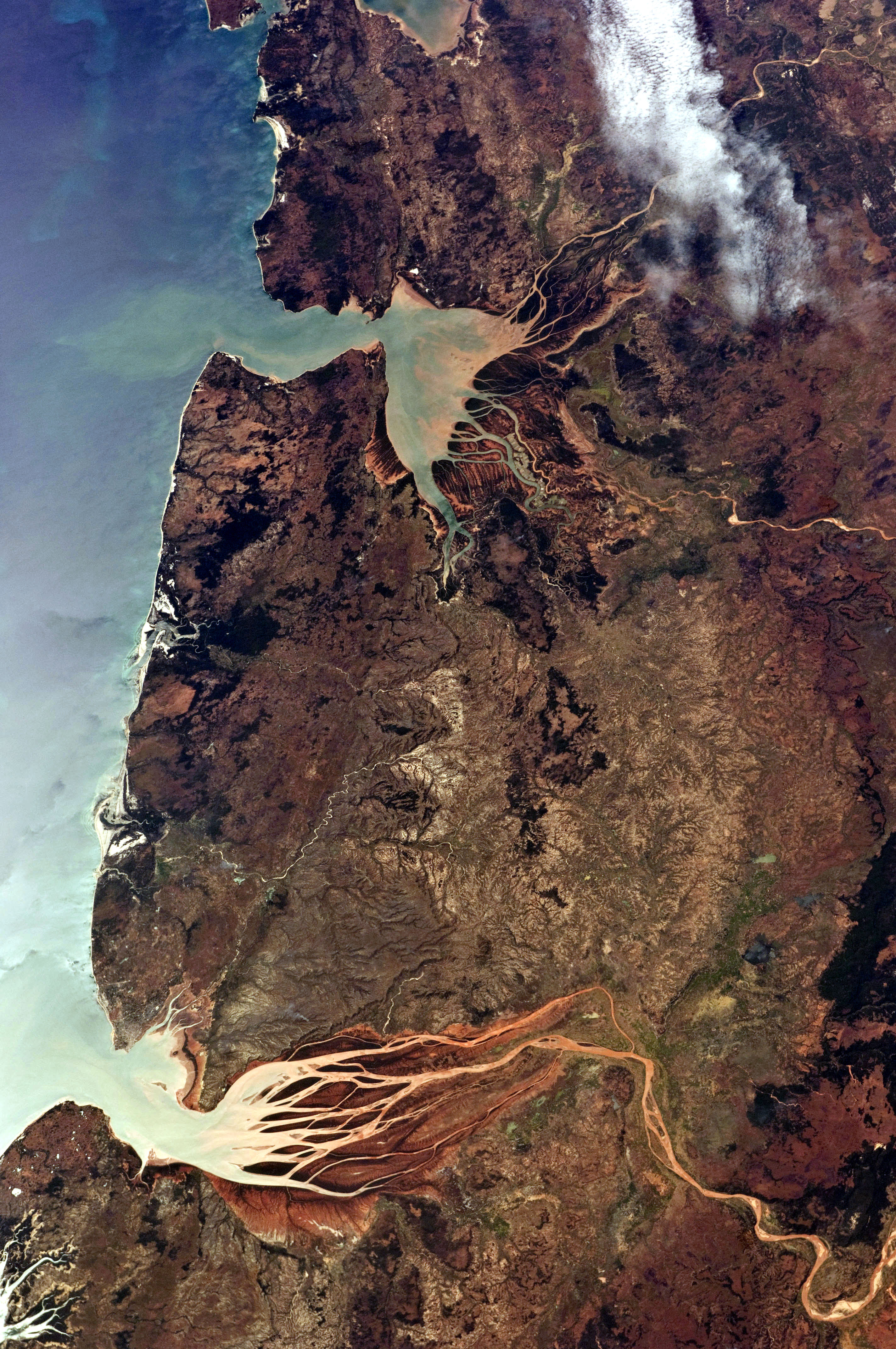
English: This astronaut photograph, taken from the International Space Station, highlights two estuaries along the north-western coastline of Madagascar. Bombetoka Bay (image upper left) is fed by the Betsiboka River, and is a frequent subject of astronaut photography due to its striking red floodplain sediments. Mahajamba Bay (image right) is fed by several rivers, including the Mahajamba and Sofia. |
| 日期 | |
| 來源 | NASA Earth Observatory |
| 作者 | ISS Astronaut photograph |
| 拍攝地點 | | 位於此地的本圖片與其他圖片: OpenStreetMap |
|---|
本圖像或影音收錄於美國國家航空暨太空總署 (NASA)休士頓太空中心(Johnson Space Center),其照片編號為: ISS028-E-6687 此標籤不表示文件的著作權狀態。任何文件在附有此標籤的同時還需要一個有效的著作權標籤。請參閱許可協議說明頁面以了解更多資訊。 其他語言:
|
授權條款
| 本作品由NASA創作,屬於公有領域。根據NASA的版權政策:“NASA的創作除非另有聲明否則不受版權保護。”(參見:Template:PD-USGov/zh,NASA版權政策或JPL圖像使用政策) | ||
 |
警告:
|
| 註解 | 該圖片含有註解:在維基媒體共享資源上查看註解 |
檔案歷史
點選日期/時間以檢視該時間的檔案版本。
| 日期/時間 | 縮圖 | 尺寸 | 使用者 | 備註 | |
|---|---|---|---|---|---|
| 目前 | 2021年5月16日 (日) 08:00 | | 2,848 × 4,288(13.29 MB) | SteinsplitterBot | Bot: Image rotated by 270° |
| 2011年6月13日 (一) 11:30 |  | 4,288 × 2,848(13.3 MB) | Originalwana | {{Information |Description ={{en|1=This astronaut photograph, taken from the International Space Station, highlights two estuaries along the north-western coastline of Madagascar. Bombetoka Bay (image upper left) is fed by the [[:Category:Betsiboka |
檔案用途
下列頁面有用到此檔案:
全域檔案使用狀況
以下其他 wiki 使用了這個檔案:
- de.wikipedia.org 的使用狀況
- en.wikipedia.org 的使用狀況
- et.wikipedia.org 的使用狀況
- fr.wikipedia.org 的使用狀況
- ha.wikipedia.org 的使用狀況
- mg.wikipedia.org 的使用狀況
- ml.wikipedia.org 的使用狀況
- nl.wikipedia.org 的使用狀況
- pl.wikipedia.org 的使用狀況
- pt.wikipedia.org 的使用狀況
- ro.wikipedia.org 的使用狀況
- ru.wikipedia.org 的使用狀況
- sh.wikipedia.org 的使用狀況
- sl.wikipedia.org 的使用狀況
- sr.wikipedia.org 的使用狀況