
File:Faroe Islands, Eysturoy, road from Skipanes to Syðrugøta.jpg
預覽大小:800 × 531 像素。 其他解析度:320 × 213 像素 | 640 × 425 像素 | 1,024 × 680 像素 | 1,501 × 997 像素。
原始檔案 (1,501 × 997 像素,檔案大小:710 KB,MIME 類型:image/jpeg)
摘要
| 描述 |
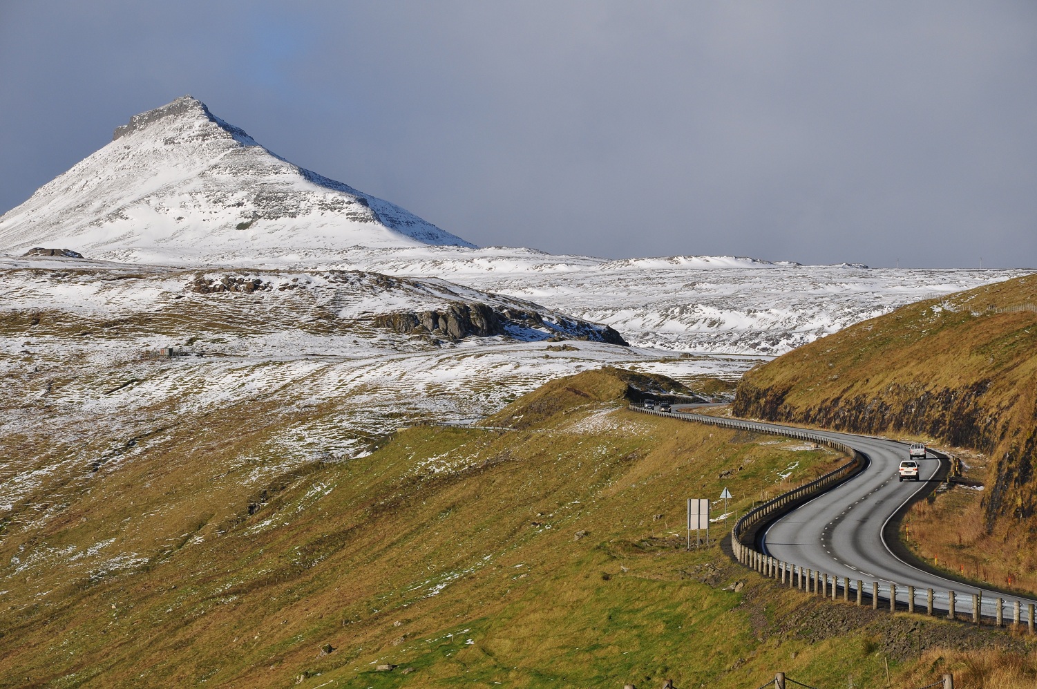
English: The road network on the Faroe Islands is excellent, considering the small number of people living there. Six of the main islands are connected by tunnels, bridges and dams. Shown is the road from Skipanes and Soldarfjordur to Syðrugøta on the island Eysturoy.
Nederlands: Het wegennet op de Faeroer eilanden is uitstekend. Zes eilanden zijn onderling verbonden met tunnels, bruggen en dammen, en ook op de eilanden zelf zijn lange tunnels gegraven voor het bereikbaar maken van piepkleine dorpen. Op de foto de weg van Skipanes en Soldarfjordur naar Syðrugøta op het eiland Eysturoy. |
| 日期 | 攝於2010年10月22日 |
| 來源 | 自己的作品 |
| 作者 | Vincent van Zeijst (留言 · 貢獻) |
| 拍攝地點 | | 位於此地的本圖片與其他圖片: OpenStreetMap |
|---|
授權條款
我,本作品的著作權持有者,決定用以下授權條款發佈本作品:
此檔案採用創用CC 姓名標示-相同方式分享 3.0 未在地化版本授權條款。
- 您可以自由:
- 分享 – 複製、發佈和傳播本作品
- 重新修改 – 創作演繹作品
- 惟需遵照下列條件:
- 姓名標示 – 您必須指名出正確的製作者,和提供授權條款的連結,以及表示是否有對內容上做出變更。您可以用任何合理的方式來行動,但不得以任何方式表明授權條款是對您許可或是由您所使用。
- 相同方式分享 – 如果您利用本素材進行再混合、轉換或創作,您必須基於如同原先的相同或兼容的條款,來分布您的貢獻成品。
檔案歷史
點選日期/時間以檢視該時間的檔案版本。
| 日期/時間 | 縮圖 | 尺寸 | 使用者 | 備註 | |
|---|---|---|---|---|---|
| 目前 | 2010年11月16日 (二) 16:04 | | 1,501 × 997(710 KB) | Loranchet | {{Information |Description={{en|1=The road network on the Faroe Islands is excellent, considering the small numer of people living there. Six of the main islands are connected by tunnels, bridges and dams. Shown is the road from Skipanes to Syđrugøta on |
檔案用途
下列頁面有用到此檔案:
全域檔案使用狀況
以下其他 wiki 使用了這個檔案:
- af.wikipedia.org 的使用狀況
- cs.wikipedia.org 的使用狀況
- da.wikipedia.org 的使用狀況
- de.wikipedia.org 的使用狀況
- en.wikipedia.org 的使用狀況
- en.wikivoyage.org 的使用狀況
- es.wikivoyage.org 的使用狀況
- fa.wikipedia.org 的使用狀況
- fo.wikipedia.org 的使用狀況
- fr.wikipedia.org 的使用狀況
- is.wikipedia.org 的使用狀況
- ka.wikipedia.org 的使用狀況
- ku.wikipedia.org 的使用狀況
- nl.wikipedia.org 的使用狀況
- pl.wikipedia.org 的使用狀況