
File:Flooding along the Rio Negro, Uruguay.jpg

預覽大小:800 × 533 像素。 其他解析度:320 × 213 像素 | 640 × 427 像素 | 1,024 × 683 像素 | 1,280 × 853 像素 | 2,049 × 1,366 像素。
原始檔案 (2,049 × 1,366 像素,檔案大小:1.61 MB,MIME 類型:image/jpeg)
摘要
| 描述 |
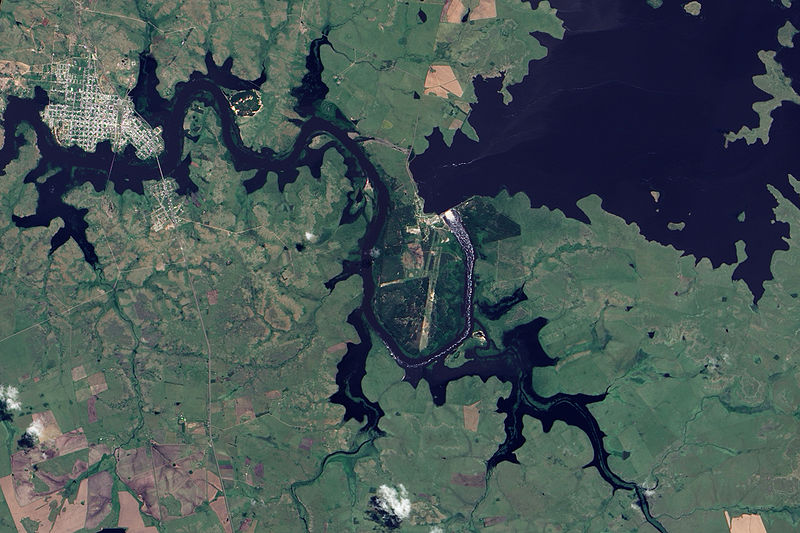
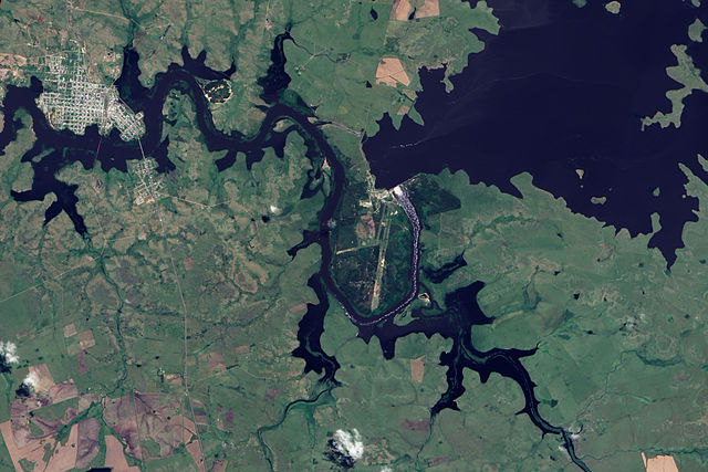
English: This true-colour image shows Rio Negro flowing past Paso de Los Toros. Throughout the scene, the river has overflowed its banks, which are still visible in places as narrow strips of plant-covered land. Flood-waters submerge not only parts of the land east of town, but also several parts of the city itself. One tributary immediately east of the city has expanded to the same width as the Rio Negro. The south-eastern quadrant of the city has been whittled away by flood-waters to form a fairly thin strip of land poking into the river. The normally straight southern edge of Paso de Los Toros looks as if the river has bitten into it with massive teeth. |
| 日期 | |
| 來源 | NASA Earth Observatory |
| 作者 | Jesse Allen |
Image captured by the Advanced Land Imager (ALI) on NASA’s Earth Observing-1 (EO-1) satellite. Image created using EO-1 ALI data provided courtesy of the NASA EO-1 team. Instrument: EO-1 - ALI
授權條款
| 本作品由NASA創作,屬於公有領域。根據NASA的版權政策:“NASA的創作除非另有聲明否則不受版權保護。”(參見:Template:PD-USGov/zh,NASA版權政策或JPL圖像使用政策) | ||
 |
警告:
|
| 註解 | 該圖片含有註解:在維基媒體共享資源上查看註解 |
檔案歷史
點選日期/時間以檢視該時間的檔案版本。
| 日期/時間 | 縮圖 | 尺寸 | 使用者 | 備註 | |
|---|---|---|---|---|---|
| 目前 | 2009年12月9日 (三) 10:33 | | 2,049 × 1,366(1.61 MB) | Originalwana | {{Information |Description={{en|1=This true-colour image shows Rio Negro flowing past Paso de Los Toros. Throughout the scene, the river has overflowed its banks, which are still visible in places as narrow strips of plant-covered land. Flood-waters subme |
檔案用途
下列頁面有用到此檔案:
全域檔案使用狀況
以下其他 wiki 使用了這個檔案:
- en.wikipedia.org 的使用狀況
- he.wikipedia.org 的使用狀況
- hr.wikipedia.org 的使用狀況
- mk.wikipedia.org 的使用狀況
- simple.wikipedia.org 的使用狀況
- sv.wikipedia.org 的使用狀況
- uk.wikipedia.org 的使用狀況
- vec.wikipedia.org 的使用狀況