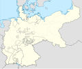
File:German Empire blank map.svg
外觀

此 SVG 檔案的 PNG 預覽的大小:754 × 599 像素。 其他解析度:302 × 240 像素 | 604 × 480 像素 | 966 × 768 像素 | 1,280 × 1,018 像素 | 2,560 × 2,035 像素 | 1,425 × 1,133 像素。
原始檔案 (SVG 檔案,表面大小:1,425 × 1,133 像素,檔案大小:1,014 KB)
檔案歷史
點選日期/時間以檢視該時間的檔案版本。
| 日期/時間 | 縮圖 | 尺寸 | 使用者 | 備註 | |
|---|---|---|---|---|---|
| 目前 | 2024年6月1日 (六) 22:26 |  | 1,425 × 1,133(1,014 KB) | Alphathon | Corrected Austro-Hungrian–Russian border |
| 2021年8月2日 (一) 03:06 |  | 1,425 × 1,133(1,011 KB) | Milenioscuro | new scheme | |
| 2015年11月2日 (一) 23:14 |  | 976 × 818(756 KB) | Alphathon | Removed Dutch Zuiderzee Polders, which did not yet exist at the time of the German Empire | |
| 2015年11月2日 (一) 16:33 |  | 976 × 818(759 KB) | Alphathon | Corrected Schleswig-Holstein border (was part of Prussia but was shown as being separate) | |
| 2014年9月9日 (二) 22:19 |  | 976 × 818(767 KB) | Milenioscuro | User created page with UploadWizard |
檔案用途
沒有使用此檔案的頁面。
全域檔案使用狀況
以下其他 wiki 使用了這個檔案:
- de.wikipedia.org 的使用狀況
- sl.wikipedia.org 的使用狀況

