
File:Ilha de Mocambique.jpg

預覽大小:800 × 533 像素。 其他解析度:320 × 213 像素 | 640 × 426 像素 | 1,024 × 682 像素 | 1,280 × 853 像素 | 2,560 × 1,706 像素 | 3,747 × 2,497 像素。
原始檔案 (3,747 × 2,497 像素,檔案大小:6.42 MB,MIME 類型:image/jpeg)
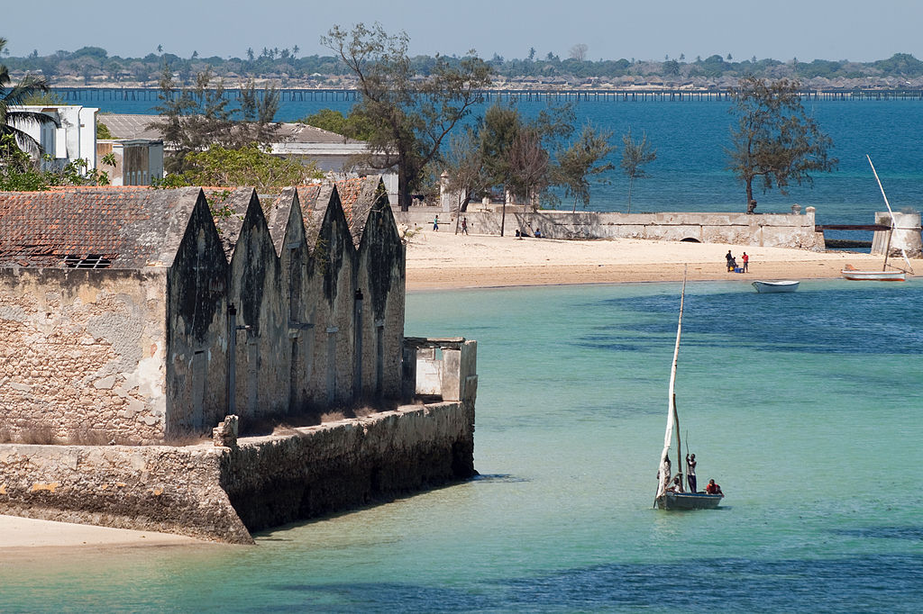
| 描述 | Ilha de Mocambique seen from Fort San Sebastiao, in background the bridge connected to the mainland |
| 日期 | 攝於2007年11月16日, 09:18 |
| 來源 | Island of Mozambique |
| 作者 | Stig Nygaard from Copenhagen, Denmark |
| 拍攝地點 | | 位於此地的本圖片與其他圖片: OpenStreetMap |
|---|
授權條款
此檔案採用創用CC 姓名標示 2.0 通用版授權條款。
- 您可以自由:
- 分享 – 複製、發佈和傳播本作品
- 重新修改 – 創作演繹作品
- 惟需遵照下列條件:
- 姓名標示 – 您必須指名出正確的製作者,和提供授權條款的連結,以及表示是否有對內容上做出變更。您可以用任何合理的方式來行動,但不得以任何方式表明授權條款是對您許可或是由您所使用。
| This image, originally posted to Flickr, was reviewed on 8 August 2008 by the administrator or reviewer Cirt, who confirmed that it was available on Flickr under the stated license on that date. |
檔案歷史
點選日期/時間以檢視該時間的檔案版本。
| 日期/時間 | 縮圖 | 尺寸 | 使用者 | 備註 | |
|---|---|---|---|---|---|
| 目前 | 2013年1月26日 (六) 11:32 | | 3,747 × 2,497(6.42 MB) | Slick-o-bot | Bot: convert to a non-interlaced jpeg (see bug #17645) |
| 2008年8月8日 (五) 20:07 |  | 3,747 × 2,497(6.21 MB) | Chin tin tin | {{Information |Description= Ilha de Mocambique seen from Fort San Sebastiao, in background the bridge connected to the mainland |Source=[http://www.flickr.com/photos/10259776@N00/2735273755/ Island of Mozambique] |Date=November 16, 2007 at 09:18 |Author=[ |
檔案用途
下列頁面有用到此檔案:
全域檔案使用狀況
以下其他 wiki 使用了這個檔案:
- af.wikipedia.org 的使用狀況
- avk.wikipedia.org 的使用狀況
- cs.wikipedia.org 的使用狀況
- de.wikipedia.org 的使用狀況
- de.wikivoyage.org 的使用狀況
- en.wikipedia.org 的使用狀況
- eo.wikipedia.org 的使用狀況
- es.wikipedia.org 的使用狀況
- fr.wikipedia.org 的使用狀況
- gl.wikipedia.org 的使用狀況
- he.wikivoyage.org 的使用狀況
- hr.wikipedia.org 的使用狀況
- hu.wikipedia.org 的使用狀況
- it.wikipedia.org 的使用狀況
- it.wikivoyage.org 的使用狀況
- ja.wikipedia.org 的使用狀況
- lt.wikipedia.org 的使用狀況
- lt.wiktionary.org 的使用狀況
- mg.wikipedia.org 的使用狀況
- mt.wikipedia.org 的使用狀況
- nl.wikipedia.org 的使用狀況
- pl.wikipedia.org 的使用狀況
- pt.wikipedia.org 的使用狀況
- ru.wikivoyage.org 的使用狀況
- sh.wikipedia.org 的使用狀況
- sk.wikipedia.org 的使用狀況
- uk.wikipedia.org 的使用狀況