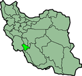
File:IranKohkiluyehBuyerAhmad.png
外觀

預覽大小:648 × 599 像素。 其他解析度:260 × 240 像素 | 519 × 480 像素 | 879 × 813 像素。
原始檔案 (879 × 813 像素,檔案大小:25 KB,MIME 類型:image/png)
檔案歷史
點選日期/時間以檢視該時間的檔案版本。
| 日期/時間 | 縮圖 | 尺寸 | 使用者 | 備註 | |
|---|---|---|---|---|---|
| 目前 | 2013年6月23日 (日) 23:59 |  | 879 × 813(25 KB) | BasilLeaf | بروزرسانی مرز بین استانهای یزد و خراسان جنوبی، تهران و البرز، فارس و یزد و اصفهان |
| 2010年11月12日 (五) 11:52 |  | 879 × 813(41 KB) | M samadi | Border of some provinces updated. | |
| 2010年10月13日 (三) 13:07 |  | 697 × 614(116 KB) | Amin19850 | Tehran & Alborz Province is divided | |
| 2007年3月10日 (六) 23:18 |  | 697 × 614(94 KB) | KureCewlik81 | ||
| 2006年11月8日 (三) 16:30 |  | 200 × 185(10 KB) | Raymond | transparent background, improved color palette | |
| 2005年9月17日 (六) 10:47 |  | 200 × 185(20 KB) | Dodo | Province of Kohkiluyeh and Buyer Ahmad, Iran Taken from en:Image:IranKohkiluyehBuyerAhmad.png Created by en:User:Morwen {{GFDL}} Category:Maps of Iran |
檔案用途
沒有使用此檔案的頁面。
全域檔案使用狀況
以下其他 wiki 使用了這個檔案:
- ar.wikipedia.org 的使用狀況
- arz.wikipedia.org 的使用狀況
- az.wikipedia.org 的使用狀況
- bn.wikipedia.org 的使用狀況
- ca.wikipedia.org 的使用狀況
- ceb.wikipedia.org 的使用狀況
- ckb.wikipedia.org 的使用狀況
- da.wikipedia.org 的使用狀況
- el.wikipedia.org 的使用狀況
- en.wikipedia.org 的使用狀況
- Dogonbadan
- Template:KohgiluyehBoyerAhmad-geo-stub
- User:AlexNebraska/Images of Iran
- Sisakht
- Munah
- Basht County
- Margown
- Garab-e Sofla
- Ludab District
- Central District (Boyer-Ahmad County)
- Qaleh Raisi
- Charusa District
- Charam, Iran
- Landeh
- Landeh District
- Dehdasht
- Suq, Iran
- Central District (Kohgiluyeh County)
- Dishmuk
- Dishmuk District
- Sarfaryab District
- Central District (Gachsaran County)
- Basht
- Pataveh
- Pataveh District
- Central District (Dana County)
- Chitab
- Kabgian District
- Likak
- Central District (Bahmai County)
- Sar Asiab-e Yusefi District
- Safi Khani
- Central District (Basht County)
- Basht District
- Central District (Charam County)
- Mirza Rahim
- Rizak
- Rak, Iran
- Duruh
檢視此檔案的更多全域使用狀況。


