
File:Jerez.svg

此 SVG 檔案的 PNG 預覽的大小:611 × 600 像素。 其他解析度:245 × 240 像素 | 489 × 480 像素 | 782 × 768 像素 | 1,043 × 1,024 像素 | 2,086 × 2,048 像素 | 1,085 × 1,065 像素。
原始檔案 (SVG 檔案,表面大小:1,085 × 1,065 像素,檔案大小:30 KB)
摘要
| 描述 |
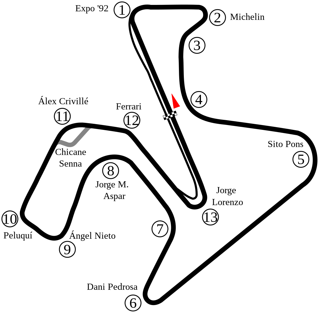
English: Track map of Circuito Permanente de Jerez. |
| 日期 | |
| 來源 | 自己的作品 |
| 作者 | Will Pittenger |
| 其他版本 |
|

| 拍攝地點 | | 位於此地的本圖片與其他圖片: OpenStreetMap |
|---|
授權條款
| 我,此作品的版權所有人,釋出此作品至公共領域。此授權條款在全世界均適用。 這可能在某些國家不合法,如果是的話: 我授予任何人有權利使用此作品於任何用途,除受法律約束外,不受任何限制。 |
檔案歷史
點選日期/時間以檢視該時間的檔案版本。
| 日期/時間 | 縮圖 | 尺寸 | 使用者 | 備註 | |
|---|---|---|---|---|---|
| 目前 | 2022年5月29日 (日) 08:35 | | 1,085 × 1,065(30 KB) | Sentoan | Cambios menores curvas 7 y 11 |
| 2022年5月29日 (日) 08:22 |  | 1,085 × 1,065(30 KB) | Sentoan | Corrigiendo nombre de Curva 6, Anchura del trazado real, perfilando algunas curvas | |
| 2015年5月4日 (一) 04:03 |  | 1,225 × 1,134(34 KB) | Uppsalo | Created a more accurate map from satellite image. | |
| 2015年5月2日 (六) 16:14 |  | 1,164 × 933(27 KB) | Uppsalo | Removed text over path, since it creates problem during PNG rendering | |
| 2015年5月2日 (六) 13:31 |  | 1,164 × 933(27 KB) | Uppsalo | Updated names of corners (Lorenzo, Aspar and Ferrari corners) | |
| 2008年7月18日 (五) 09:39 |  | 1,164 × 933(80 KB) | Will Pittenger | New version gets around the Mediawiki/RSVG bug where text on path objects are omitted by converting those objects to paths. If you need to edit the file, please use the previous version. | |
| 2008年7月18日 (五) 09:35 |  | 1,164 × 933(34 KB) | Will Pittenger | Moved Turn 11's marker closer to the turn. | |
| 2008年7月18日 (五) 09:16 |  | 1,164 × 933(34 KB) | Will Pittenger | {{Information |Description={{en|1=Track map of w:Circuito Permanente de Jerez.}} |Source=Own work by uploader |Author=Will Pittenger |Date=7-18-2008 |Permission= |other_versions=<gallery>Image:Circuit Jerez.png|Old version &md |
檔案用途
下列頁面有用到此檔案:
全域檔案使用狀況
以下其他 wiki 使用了這個檔案:
- af.wikipedia.org 的使用狀況
- ar.wikipedia.org 的使用狀況
- جائزة إسبانيا الكبرى للدراجات النارية 2006
- جائزة إسبانيا الكبرى للدراجات النارية 2007
- جائزة إسبانيا الكبرى للدراجات النارية 2008
- جائزة إسبانيا الكبرى للدراجات النارية 2009
- جائزة إسبانيا الكبرى للدراجات النارية 2010
- جائزة إسبانيا الكبرى للدراجات النارية 2011
- جائزة إسبانيا الكبرى للدراجات النارية 2000
- جائزة إسبانيا الكبرى للدراجات النارية 1989
- جائزة إسبانيا الكبرى للدراجات النارية 1990
- جائزة إسبانيا الكبرى للدراجات النارية 1992
- جائزة إسبانيا الكبرى للدراجات النارية 1993
- جائزة إسبانيا الكبرى للدراجات النارية 1994
- جائزة إسبانيا الكبرى للدراجات النارية 1995
- جائزة إسبانيا الكبرى للدراجات النارية 1996
- جائزة إسبانيا الكبرى للدراجات النارية 1998
- جائزة إسبانيا الكبرى للدراجات النارية 1999
- جائزة إسبانيا الكبرى للدراجات النارية 2018
- جائزة إسبانيا الكبرى للدراجات النارية 2019
- ast.wikipedia.org 的使用狀況
- bg.wikipedia.org 的使用狀況
- bn.wikipedia.org 的使用狀況
- ca.wikipedia.org 的使用狀況
- Circuit de Jerez
- Gran Premi d'Espanya de motociclisme de 2009
- Temporada 2011 de Fórmula 1
- Gran Premi Expo 92 de motociclisme
- Gran Premi d'Espanya de motociclisme
- Gran Premi d'Espanya de motociclisme de 2010
- Gran Premi d'Espanya de motociclisme de 2020
- Gran Premi d'Andalusia de motociclisme de 2020
- Gran Premi d'Espanya de motociclisme de 2021
- Gran Premi d'Espanya de motociclisme de 2018
- de.wikipedia.org 的使用狀況
- en.wikipedia.org 的使用狀況
檢視此檔案的更多全域使用狀況。