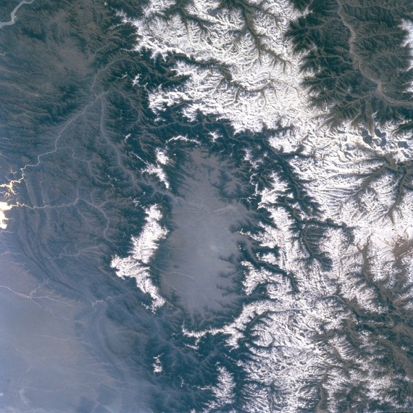
File:Kashmir-sat-nasa.jpg
外觀

預覽大小:600 × 600 像素。 其他解析度:240 × 240 像素 | 480 × 480 像素 | 640 × 640 像素。
原始檔案 (640 × 640 像素,檔案大小:428 KB,MIME 類型:image/jpeg)
檔案歷史
點選日期/時間以檢視該時間的檔案版本。
| 日期/時間 | 縮圖 | 尺寸 | 使用者 | 備註 | |
|---|---|---|---|---|---|
| 目前 | 2011年5月17日 (二) 15:45 |  | 640 × 640(428 KB) | Woudloper | {{Information |Description={{en|Public domain NASA image: http://eol.jsc.nasa.gov/sseop/EFS/images.pl?photo=STS066-127-79}} |Source=Transferred from [http://en.wikipedia.org en.wikipedia] |Date={{Date|2009|04|01}} (original upload date) |Author=Original u |
檔案用途
全域檔案使用狀況
以下其他 wiki 使用了這個檔案:
- ar.wikipedia.org 的使用狀況
- be.wikipedia.org 的使用狀況
- bh.wikipedia.org 的使用狀況
- bn.wikipedia.org 的使用狀況
- de.wikipedia.org 的使用狀況
- de.wikivoyage.org 的使用狀況
- dty.wikipedia.org 的使用狀況
- en.wikipedia.org 的使用狀況
- en.wikivoyage.org 的使用狀況
- es.wikipedia.org 的使用狀況
- fa.wikipedia.org 的使用狀況
- frr.wikipedia.org 的使用狀況
- fr.wikipedia.org 的使用狀況
- fr.wikinews.org 的使用狀況
- fr.wikivoyage.org 的使用狀況
- gu.wikipedia.org 的使用狀況
- he.wikipedia.org 的使用狀況
- hi.wikipedia.org 的使用狀況
- id.wikipedia.org 的使用狀況
- ja.wikipedia.org 的使用狀況
- kn.wikipedia.org 的使用狀況
- ko.wikipedia.org 的使用狀況
- ks.wikipedia.org 的使用狀況
- ml.wikipedia.org 的使用狀況
- mr.wikipedia.org 的使用狀況
- ms.wikipedia.org 的使用狀況
- ne.wikipedia.org 的使用狀況
- nl.wikipedia.org 的使用狀況
- nn.wikipedia.org 的使用狀況
- os.wikipedia.org 的使用狀況
- pa.wikipedia.org 的使用狀況
- pl.wikipedia.org 的使用狀況
- pnb.wikipedia.org 的使用狀況
- ru.wikipedia.org 的使用狀況
- ru.wikinews.org 的使用狀況
- sa.wikipedia.org 的使用狀況
- simple.wikipedia.org 的使用狀況
檢視此檔案的更多全域使用狀況。


