
File:Map of Hawaii highlighting Hawaii (island).svg

此 SVG 檔案的 PNG 預覽的大小:800 × 538 像素。 其他解析度:320 × 215 像素 | 640 × 431 像素 | 1,024 × 689 像素 | 1,280 × 862 像素 | 2,560 × 1,723 像素 | 6,063 × 4,081 像素。
原始檔案 (SVG 檔案,表面大小:6,063 × 4,081 像素,檔案大小:12 KB)
.svg?uselang=zh-hant)
.svg?uselang=zh-hant)
.svg?action=history&uselang=zh-hant)
.svg)
摘要
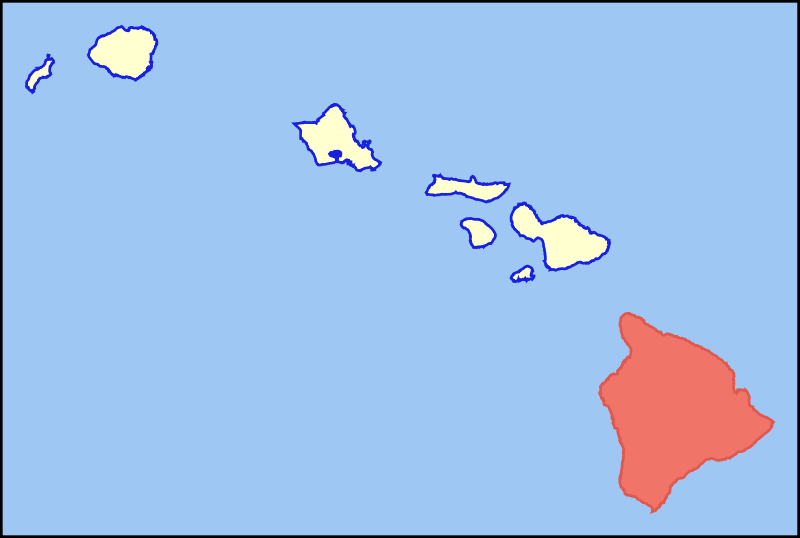
| 描述 | Colored locator map for the island of Hawaii |
| 日期 | |
| 來源 | Based on the SVG file that was released to the public domain by David Benbennick at Wikipedia: Image:Map_of_Hawaii_highlighting_Kalawao_County.svg |
| 作者 | MattWright |
授權條款
| 此作品已由其作者,I, MattWright,釋出至公有領域。此授權條款在全世界均適用。 這可能在某些國家不合法,如果是的話: I, MattWright授予任何人有權利使用此作品於任何用途,除受法律約束外,不受任何限制。 |
檔案歷史
點選日期/時間以檢視該時間的檔案版本。
| 日期/時間 | 縮圖 | 尺寸 | 使用者 | 備註 | |
|---|---|---|---|---|---|
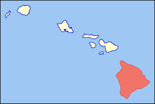
| 目前 | 2007年7月30日 (一) 08:33 | | 6,063 × 4,081(12 KB) | MattWright | == Summary == {{Information |Description=Colored locator map for the island of Kauai |Source=Based on the SVG file that was released to the public domain by [http://commons.wikimedia.org/wiki/User:Dbenbenn David Benbennick] at [http://en.wikipedia.org/wik |
檔案用途
下列頁面有用到此檔案:
全域檔案使用狀況
以下其他 wiki 使用了這個檔案:
- af.wikipedia.org 的使用狀況
- als.wikipedia.org 的使用狀況
- ar.wikipedia.org 的使用狀況
- az.wiktionary.org 的使用狀況
- bg.wikipedia.org 的使用狀況
- br.wikipedia.org 的使用狀況
- ca.wikipedia.org 的使用狀況
- de.wikipedia.org 的使用狀況
- de.wikivoyage.org 的使用狀況
- el.wikipedia.org 的使用狀況
- en.wikipedia.org 的使用狀況
- eo.wikipedia.org 的使用狀況
- es.wikipedia.org 的使用狀況
- fr.wiktionary.org 的使用狀況
- fy.wikipedia.org 的使用狀況
- ga.wikipedia.org 的使用狀況
- haw.wikipedia.org 的使用狀況
- hi.wikipedia.org 的使用狀況
- hu.wikipedia.org 的使用狀況
- ia.wikipedia.org 的使用狀況
- id.wikipedia.org 的使用狀況
- is.wikipedia.org 的使用狀況
- it.wikivoyage.org 的使用狀況
- ja.wikipedia.org 的使用狀況
- lt.wikipedia.org 的使用狀況
- ms.wikipedia.org 的使用狀況
- pt.wikipedia.org 的使用狀況
- ro.wikipedia.org 的使用狀況
- sk.wikipedia.org 的使用狀況
- sv.wikipedia.org 的使用狀況
- tg.wikipedia.org 的使用狀況
- th.wikipedia.org 的使用狀況
- ur.wikipedia.org 的使用狀況
檢視此檔案的更多全域使用狀況。
.svg)
.svg)