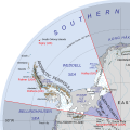
File:Map of Queen Elizabeth Land, BAT.svg
外觀

此 SVG 檔案的 PNG 預覽的大小:486 × 484 像素。 其他解析度:241 × 240 像素 | 482 × 480 像素 | 771 × 768 像素 | 1,028 × 1,024 像素 | 2,056 × 2,048 像素。
原始檔案 (SVG 檔案,表面大小:486 × 484 像素,檔案大小:4.56 MB)
檔案歷史
點選日期/時間以檢視該時間的檔案版本。
| 日期/時間 | 縮圖 | 尺寸 | 使用者 | 備註 | |
|---|---|---|---|---|---|
| 目前 | 2020年1月25日 (六) 20:11 |  | 486 × 484(4.56 MB) | Hogweard | Typo |
| 2020年1月12日 (日) 15:06 |  | 486 × 484(4.56 MB) | Hogweard | Or maybe this time: all labels rewitten | |
| 2020年1月6日 (一) 23:16 |  | 486 × 484(4.33 MB) | Hogweard | I think I've got it this time | |
| 2019年12月29日 (日) 23:51 |  | 486 × 484(4.24 MB) | Hogweard | Trying yet again | |
| 2018年1月28日 (日) 09:07 |  | 486 × 484(4.46 MB) | Hogweard | Trying again.... | |
| 2017年12月20日 (三) 23:49 |  | 486 × 484(4.5 MB) | Hogweard | - and again | |
| 2017年12月20日 (三) 23:45 |  | 486 × 484(4.5 MB) | Hogweard | Trying again with the names | |
| 2017年10月1日 (日) 14:21 |  | 486 × 484(4.47 MB) | Hogweard | Fixed names | |
| 2017年10月1日 (日) 14:04 |  | 486 × 484(4.47 MB) | Hogweard | =={{int:filedesc}}== {{Information |description={{en|1=Map of British Antarctic Territory showing Queen Elizabeth Land}} |date=2017-10-01 |source={{f|British Antarctic Territory (in Antarctica).svg}} |author=*{{f|British Antarctic Territory (in Antarct... |
檔案用途
下列頁面有用到此檔案:
全域檔案使用狀況
以下其他 wiki 使用了這個檔案:
- ang.wikipedia.org 的使用狀況
- de.wikipedia.org 的使用狀況
- en.wikipedia.org 的使用狀況
- he.wikipedia.org 的使用狀況
- it.wikipedia.org 的使用狀況
- ka.wikipedia.org 的使用狀況
- mk.wikipedia.org 的使用狀況
- tr.wikipedia.org 的使用狀況
- vi.wikipedia.org 的使用狀況


