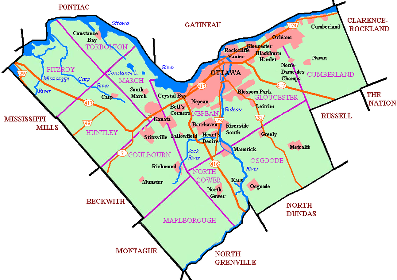
File:Newottawamap.png
外觀

預覽大小:800 × 565 像素。 其他解析度:320 × 226 像素 | 640 × 452 像素 | 903 × 638 像素。
原始檔案 (903 × 638 像素,檔案大小:165 KB,MIME 類型:image/png)
檔案歷史
點選日期/時間以檢視該時間的檔案版本。
| 日期/時間 | 縮圖 | 尺寸 | 使用者 | 備註 | |
|---|---|---|---|---|---|
| 目前 | 2005年5月1日 (日) 08:56 |  | 903 × 638(165 KB) | Peregrine981 | Originally uploaded to en wiki as Image:Newottawamap.png by creator en:User:Early Andrew on March 16, 2005 Released by author to the public domain. {{PD}} Category:Ottawa Category:Maps |
檔案用途
下列4個頁面有用到此檔案:
全域檔案使用狀況
以下其他 wiki 使用了這個檔案:
- ang.wikipedia.org 的使用狀況
- ar.wikipedia.org 的使用狀況
- ay.wikipedia.org 的使用狀況
- bn.wikipedia.org 的使用狀況
- ca.wikipedia.org 的使用狀況
- de.wikipedia.org 的使用狀況
- de.wikivoyage.org 的使用狀況
- en.wikipedia.org 的使用狀況
- Ottawa
- Rockcliffe Park
- Riverview, Ottawa
- Westboro, Ottawa
- Blossom Park
- Kanata, Ontario
- Cumberland, Ontario
- New Edinburgh
- Old Ottawa South
- Richmond, Ontario
- TD Place Stadium
- Dow's Lake
- Heron Gate
- Children's Hospital of Eastern Ontario
- Orleans, Ontario
- Barrhaven
- Downtown Ottawa
- Old Ottawa East
- Cumberland, Ottawa
- Stittsville
- Constance Bay
- Ottawa Macdonald–Cartier International Airport
- Ottawa/Rockcliffe Airport
- Carp Airport
- Munster, Ontario
- City of Ottawa
- List of airports in the Ottawa area
- Kars/Rideau Valley Air Park
- Centrepointe
- Manotick
- Carp, Ontario
- Hintonburg
- Mechanicsville, Ottawa
- Ottawa station
- Tremblay station
- Osgoode, Ontario
- Lindenlea
- Metcalfe, Ontario
- Britannia, Ottawa
- Burritts Rapids
- Huntley Township, Ontario
- Torbolton Township
- Talk:Ottawa station
檢視此檔案的更多全域使用狀況。


