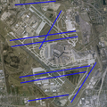
File:O'Hare International Airport (USGS) Final.png

預覽大小:600 × 600 像素。 其他解析度:240 × 240 像素 | 480 × 480 像素 | 768 × 768 像素 | 1,132 × 1,132 像素。
原始檔案 (1,132 × 1,132 像素,檔案大小:2.1 MB,MIME 類型:image/png)
檔案歷史
點選日期/時間以檢視該時間的檔案版本。
| 日期/時間 | 縮圖 | 尺寸 | 使用者 | 備註 | |
|---|---|---|---|---|---|
| 目前 | 2009年2月18日 (三) 23:55 |  | 1,132 × 1,132(2.1 MB) | Mahahahaneapneap | Compressed |
| 2007年6月30日 (六) 20:29 |  | 1,132 × 1,132(2.12 MB) | Brianski | De-interlaced and ran through optipng. (Note: Interlacing is a waste on an image this size, and significantly hurts the compression ratio - wiki software downsizes it the vast majority of the time anyway.) | |
| 2007年6月17日 (日) 00:12 |  | 1,132 × 1,132(2.48 MB) | Brianski | Size slightly reduced with optipng -o7 | |
| 2006年5月14日 (日) 10:00 |  | 1,132 × 1,132(2.55 MB) | Wangi | {{Information| |Description=O'Hare International Airport modernization program - final runway configuration |Source=NASA World Wind Screenshot, USGS urban ortho; [http://egov.cityofchicago.org/city/webportal/portalContentItemAction.do?BV_SessionID=@@@ |
檔案用途
下列頁面有用到此檔案:
全域檔案使用狀況
以下其他 wiki 使用了這個檔案:
- de.wikipedia.org 的使用狀況
- en.wikipedia.org 的使用狀況
- fr.wikipedia.org 的使用狀況
- id.wikipedia.org 的使用狀況
- pl.wikipedia.org 的使用狀況
- ru.wikipedia.org 的使用狀況
- th.wikipedia.org 的使用狀況


