
File:Osmanli Ortadogu.jpg

預覽大小:786 × 600 像素。 其他解析度:315 × 240 像素 | 629 × 480 像素 | 1,006 × 768 像素 | 1,280 × 977 像素 | 2,560 × 1,954 像素 | 7,374 × 5,629 像素。
原始檔案 (7,374 × 5,629 像素,檔案大小:9.42 MB,MIME 類型:image/jpeg)
摘要
| 描述 |
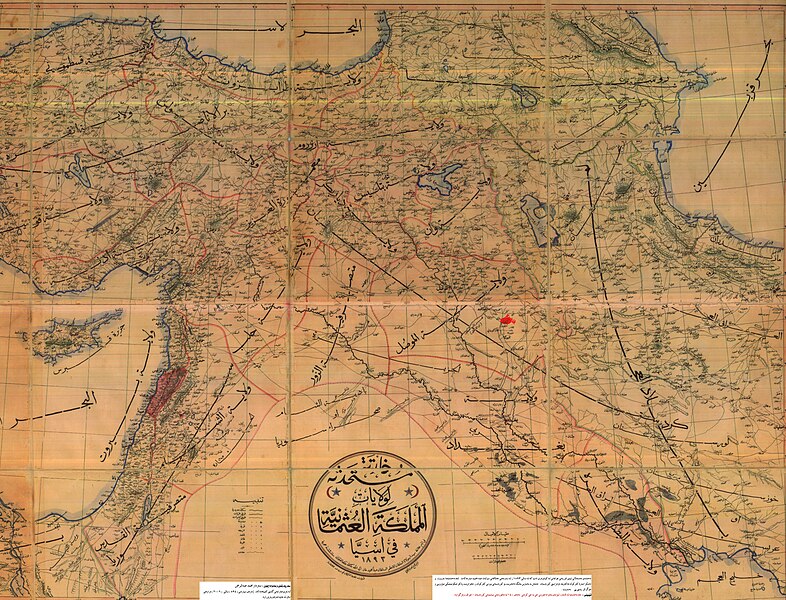
English: An Ottoman-era (1893) map of the Middle East, with the city of Kirkuk highlighted in the Mosul Vilayet
فارسی: بندانگشتی|نقشه منطقه کردستان مربوط به سال ۱۸۹۳ میلادی. که در آن زمان شامل ایالات غربی ایران به همراه ولایات موصل و دیاربکر و وان از امپراتوری عثمانی میشدهاست.
Türkçe: II. Abdülhamit döneminde basılmış Osmanlı Devleti'nin Ortadoğu'daki topraklarını gösteren harita (1893). haritanın tam ortasında کردستان (Kürdistan) kelimesi bulunmaktadır |
| 日期 | |
| 來源 | |
| 作者 | 未知 |
授權條款
This work first published in the Ottoman Empire is now in the public domain because the Empire's copyright formalities were not met (copyright notice, registration, and deposit), or because the copyright term (30 years after the death of the author, sometimes less) expired before the Empire was dissolved (details).
|
.svg) |
原始上傳日誌
The original description page was here. All following user names refer to ku.wikipedia.
- 2007-05-26 08:12 Erdal Ronahi 7374×5629× (9881565 bytes) {{Înformasyon |Şayes=Nexşeya Asyayê |Çavkanî=Arşîvên Osmanî, pukmedia.com |Nûser=Dewleta Osmanî |Dem=1893, di serdema xîlafeta siltan Ebdulhemîd de |Lîsens={{PD-old}} }}
檔案歷史
點選日期/時間以檢視該時間的檔案版本。
| 日期/時間 | 縮圖 | 尺寸 | 使用者 | 備註 | |
|---|---|---|---|---|---|
| 目前 | 2009年3月19日 (四) 01:07 | | 7,374 × 5,629(9.42 MB) | KureCewlik81 | {{Information |Description=Anatolien zu Zeit des osmanischen Reiches 1893 |Source= |Date= |Author= |Permission= |other_versions= }} |
檔案用途
下列2個頁面有用到此檔案:
全域檔案使用狀況
以下其他 wiki 使用了這個檔案:
- ar.wikipedia.org 的使用狀況
- arz.wikipedia.org 的使用狀況
- azb.wikipedia.org 的使用狀況
- az.wikipedia.org 的使用狀況
- ckb.wikipedia.org 的使用狀況
- de.wikipedia.org 的使用狀況
- en.wikipedia.org 的使用狀況
- fa.wikipedia.org 的使用狀況
- ja.wikipedia.org 的使用狀況
- ku.wikipedia.org 的使用狀況
- mzn.wikipedia.org 的使用狀況
- ru.wikipedia.org 的使用狀況
- tr.wikipedia.org 的使用狀況