
File:Ph locator map rizal.png
無更高解析度可提供。
Ph_locator_map_rizal.png (300 × 440 像素,檔案大小:18 KB,MIME 類型:image/png)
摘要
| 描述 |
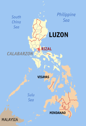
English: Map of Philippines showing the location of Rizal |
| 日期 | |
| 來源 | English Wikipedia |
| 作者 | Eugene Alvin Villar (seav) |
授權條款

|
已授權您依據自由軟體基金會發行的無固定段落、封面文字和封底文字GNU自由文件授權條款1.2版或任意後續版本,對本檔進行複製、傳播和/或修改。該協議的副本列在GNU自由文件授權條款中。 |
| 此檔案採用創用CC 姓名標示-相同方式分享 3.0 未在地化版本授權條款。 | ||
| ||
| 已新增授權條款標題至此檔案,作為GFDL授權更新的一部份。 |

|
If you choose to use this work under the Creative Commons license stated on this page, the author, Eugene Alvin Villar (seav), would like you to attribute the work to him (among other requirements such as indicating that the work is licensed under the Creative Commons) with the following text or similar:
© Eugene Alvin Villar, 2003
His name should be a link to his Wikimedia Commons userpage. If a link is not possible, then the url should be placed in parentheses after the name. If the work has been substantially altered by other people (see the File history section below), then this particular attribution requirement is waived, which means you can attribute the work in any reasonable manner. This attribution requirement is provided pursuant to the Creative Commons Attribution mechanism where "you must attribute the work in the manner specified by the author or licensor (but not in any way that suggests that they endorse you or your use of the work)." (See "Attribution" in the Creative Commons website.)
|
檔案歷史
點選日期/時間以檢視該時間的檔案版本。
| 日期/時間 | 縮圖 | 尺寸 | 使用者 | 備註 | |
|---|---|---|---|---|---|
| 目前 | 2005年12月30日 (五) 13:45 | | 300 × 440(18 KB) | Magalhães | Map of the Philippines showing the location of Rizal. Created and copyright (2003) by seav. Category:Maps of provinces of the Philippines |
| 2005年9月11日 (日) 06:57 |  | 300 × 450(14 KB) | Magalhães | Map of the Philippines showing the location of Riza. Created and copyright (2003) by seav {{GFDL}} Source: [http://en.wikipedia.org/wiki/Image:Image:Ph locator map rizal.png English wikipedia] {{GFDL}} Category:Maps of the Philippines\ |
檔案用途
沒有使用此檔案的頁面。
全域檔案使用狀況
以下其他 wiki 使用了這個檔案:
- bcl.wiktionary.org 的使用狀況