
File:Prima Europe tabula.jpg

預覽大小:800 × 572 像素。 其他解析度:320 × 229 像素 | 640 × 458 像素 | 1,024 × 733 像素 | 1,280 × 916 像素 | 2,560 × 1,832 像素 | 6,000 × 4,293 像素。
原始檔案 (6,000 × 4,293 像素,檔案大小:9.63 MB,MIME 類型:image/jpeg)
摘要
| 克勞狄烏斯·托勒密:Prima Europe Tabula
|
|||||
|---|---|---|---|---|---|
| 作家 |  | ||||
| 標題 |
Prima Europe tabula |
||||
| 所屬實體 |
地理學指南 |
||||
| 物體類型 |
地圖 |
||||
| 描述 |
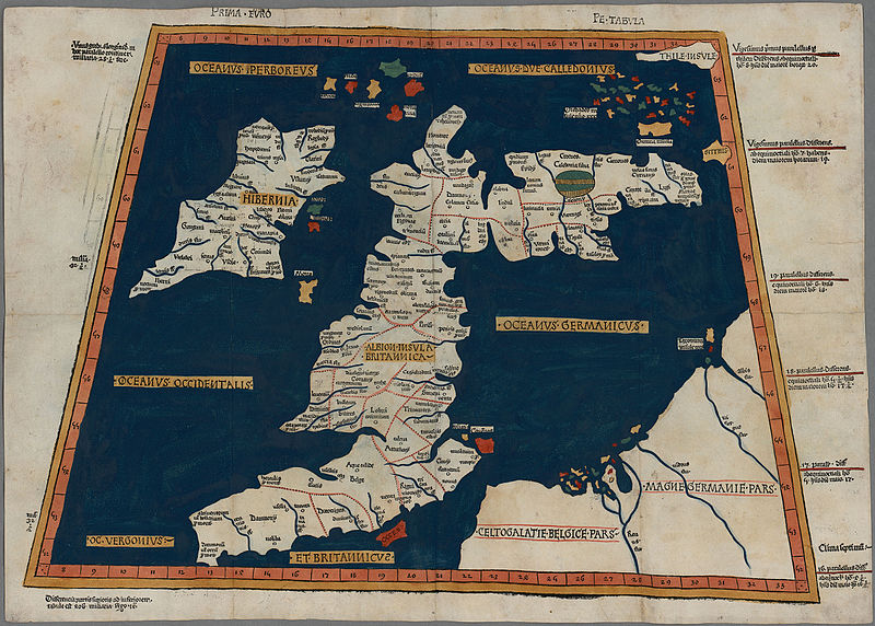
One of the earliest surviving copies of Ptolemy's 2nd century map of the British Isles. Originally published in Ptolemy's Geographia. This is the second issue of the 1482 map, also printed at Ulm, which was the first woodcut map of the British Isles and the first to be printed outside Italy. |
||||
| 日期 | 1486年 | ||||
| 尺寸 | 高度:350公釐;寬度:500公釐 | ||||
| 藏於 | |||||
| 備註 | Scale not given | ||||
| 來源/攝影者 |
|
||||
| 授權許可 (重用此檔案) |
|
||||


檔案歷史
點選日期/時間以檢視該時間的檔案版本。
| 日期/時間 | 縮圖 | 尺寸 | 使用者 | 備註 | |
|---|---|---|---|---|---|
| 目前 | 2015年10月21日 (三) 13:01 | | 6,000 × 4,293(9.63 MB) | Jason.nlw | User created page with UploadWizard |
檔案用途
下列頁面有用到此檔案:
全域檔案使用狀況
以下其他 wiki 使用了這個檔案:
- ar.wikipedia.org 的使用狀況
- cy.wikipedia.org 的使用狀況
- da.wikipedia.org 的使用狀況
- de.wikipedia.org 的使用狀況
- el.wikipedia.org 的使用狀況
- en.wikipedia.org 的使用狀況
- es.wikipedia.org 的使用狀況
- et.wikipedia.org 的使用狀況
- hr.wikipedia.org 的使用狀況
- it.wikipedia.org 的使用狀況
- www.wikidata.org 的使用狀況