
File:Rosario gas explosion - location map.png
無更高解析度可提供。
Rosario_gas_explosion_-_location_map.png (668 × 508 像素,檔案大小:123 KB,MIME 類型:image/png)
摘要
| 描述 |
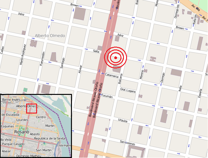
Español: Ubicación del edificio siniestrado en la explosión de gas del de agosto en Rosario |
|||
| 日期 | ||||
| 來源 | Open Street Map | |||
| 作者 | http://www.openstreetmap.org/copyright | |||
| 授權許可 (重用此檔案) |
OpenStreetMap data is available under the Open Database License (details). Map tiles are licensed under the Creative Commons Attribution-ShareAlike 2.0 license (CC-BY-SA 2.0).
此檔案採用創用CC 姓名標示-相同方式分享 2.0 通用版授權條款。
|
檔案歷史
點選日期/時間以檢視該時間的檔案版本。
| 日期/時間 | 縮圖 | 尺寸 | 使用者 | 備註 | |
|---|---|---|---|---|---|
| 目前 | 2013年8月9日 (五) 18:37 | | 668 × 508(123 KB) | Cacen Gymraeg | User created page with UploadWizard |
檔案用途
下列5個頁面有用到此檔案:
全域檔案使用狀況
以下其他 wiki 使用了這個檔案:
- ar.wikipedia.org 的使用狀況
- bn.wikipedia.org 的使用狀況
- en.wikipedia.org 的使用狀況
- es.wikipedia.org 的使用狀況
- fr.wikipedia.org 的使用狀況
- id.wikipedia.org 的使用狀況
- tr.wikipedia.org 的使用狀況
- vi.wikipedia.org 的使用狀況
- www.wikidata.org 的使用狀況