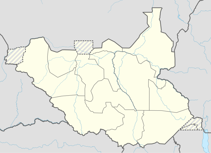
File:South Sudan adm location map.svg
外觀

此 SVG 檔案的 PNG 預覽的大小:800 × 581 像素。 其他解析度:320 × 232 像素 | 640 × 465 像素 | 1,024 × 743 像素 | 1,280 × 929 像素 | 2,560 × 1,858 像素 | 1,561 × 1,133 像素。
原始檔案 (SVG 檔案,表面大小:1,561 × 1,133 像素,檔案大小:201 KB)
檔案歷史
點選日期/時間以檢視該時間的檔案版本。
| 日期/時間 | 縮圖 | 尺寸 | 使用者 | 備註 | |
|---|---|---|---|---|---|
| 目前 | 2020年4月23日 (四) 18:25 |  | 1,561 × 1,133(201 KB) | Leviavery | Added Pibor and Ruweng Administrative Areas |
| 2020年2月25日 (二) 16:16 |  | 1,561 × 1,133(199 KB) | Myrabert01 | Reverted to version as of 13:47, 25 February 2020 (UTC) South Sudan revert back to 10 States. https://www.aljazeera.com/news/2020/02/6-years-war-peace-finally-south-sudan-200223114919537.html | |
| 2020年2月25日 (二) 14:39 |  | 1,561 × 1,133(213 KB) | NordNordWest | Reverted to version as of 14:39, 13 August 2016 (UTC); no reason for this revert | |
| 2020年2月25日 (二) 13:47 |  | 1,561 × 1,133(199 KB) | Myrabert01 | Reverted to version as of 18:18, 12 November 2014 (UTC). South Sudan revert back to 10 States. | |
| 2016年8月13日 (六) 14:39 |  | 1,561 × 1,133(213 KB) | NordNordWest | corr | |
| 2016年8月12日 (五) 12:31 |  | 1,561 × 1,133(214 KB) | NordNordWest | upd, new states | |
| 2014年11月12日 (三) 18:18 |  | 1,561 × 1,133(199 KB) | NordNordWest | == {{int:filedesc}} == {{Information |Description= {{de|1=Positionskarte von Südsudan}} {{en|1=Location map of South Sudan}} {{Location map series N |stretching=101 |top=12.7 |bottom=3.2 |left=23.15 |right=36.4 }} |Source={{Own using}} * United States... |
檔案用途
下列44個頁面有用到此檔案:
全域檔案使用狀況
以下其他 wiki 使用了這個檔案:
- ab.wikipedia.org 的使用狀況
- af.wikipedia.org 的使用狀況
- an.wikipedia.org 的使用狀況
- ast.wikipedia.org 的使用狀況
- av.wikipedia.org 的使用狀況
- azb.wikipedia.org 的使用狀況
- az.wikipedia.org 的使用狀況
- be.wikipedia.org 的使用狀況
- bg.wikipedia.org 的使用狀況
- bn.wikipedia.org 的使用狀況
- bs.wikipedia.org 的使用狀況
- ceb.wikipedia.org 的使用狀況
檢視此檔案的更多全域使用狀況。


