
File:Tamil distribution.png

預覽大小:532 × 599 像素。 其他解析度:213 × 240 像素 | 426 × 480 像素 | 682 × 768 像素 | 909 × 1,024 像素 | 1,649 × 1,858 像素。
原始檔案 (1,649 × 1,858 像素,檔案大小:567 KB,MIME 類型:image/png)
| 標題 |
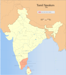
Tamil speakers map |
| 描寫 |
Detail of Image:Tamil speakers map.svg; Areas in India and Sri Lanka where Tamil is spoken (1961). |
| 日期 | |
| 來源 |
自己的作品 |
| 創作作者 | |
| 授權許可 (重用此檔案) |
我,本作品的著作權持有者,決定用以下授權條款發佈本作品: 此檔案採用創用CC 姓名標示-相同方式分享 3.0 未在地化版本授權條款。
|
| Geotemporal data | |
| 描繪日期 | 20世紀下半期和21世紀 |
| 地理參考 | 如果不合適,請設定「warp_status = skip」為隱藏。 |
| Archival data | |
| 備註 | Part of WikiProject India Maps |
檔案歷史
點選日期/時間以檢視該時間的檔案版本。
| 日期/時間 | 縮圖 | 尺寸 | 使用者 | 備註 | |
|---|---|---|---|---|---|
| 目前 | 2021年9月14日 (二) 11:38 | | 1,649 × 1,858(567 KB) | Amritsvāraya | Updated the map to 1981 |
| 2007年5月20日 (日) 19:29 |  | 366 × 319(43 KB) | Dbachmann | {{WikiProject_India_Maps |Title=Tamil speakers map |Description=Detail of Image:Tamil speakers map.svg; Areas in India and Sri Lanka where Tamil is spoken (1961). |Source= [http://www.himalmag.com/2003/april/images/inside_back_map.jpg Himalag - La |
檔案用途
全域檔案使用狀況
以下其他 wiki 使用了這個檔案:
- af.wikipedia.org 的使用狀況
- ar.wikipedia.org 的使用狀況
- azb.wikipedia.org 的使用狀況
- ca.wikipedia.org 的使用狀況
- en.wikipedia.org 的使用狀況
- Liberation Tigers of Tamil Eelam
- Tamil Nadu
- Tamil language
- Tamils
- Iyer
- List of Tamil people
- George Uglow Pope
- Tamil Jain
- Iyengar
- User talk:Deeceevoice
- Category:Tamil people
- User talk:Princenrsama~enwiki
- User talk:Sivaraj
- Louis Jacolliot
- Music of Tamil Nadu
- Murali Kartik
- Kaarkaathaar
- Hebbar Iyengar
- Eelam
- Alain Daniélou
- Tamil cuisine
- Hinduism in Sri Lanka
- User talk:Paul Raj
- Balakumaran
- Tamil Muslim
- Tamil diaspora
- Category:Tamil festivals
- Category:Tamil diaspora
- User talk:Senthilkumaras
- User:Senthilkumaras
- Category:Tamil actors
- Jaffna kingdom
- Sri Lankan Tamils
- Tamilakam
- Kongu Vellalar
- Naṟṟiṇai
- Agamudayar
- Karaiyar
- List of Sri Lankan Tamils
- History of Tamil Nadu
- Tamil Brahmin
- Elur Chetty
- User talk:Aadal
- Tamil numerals
- Kovalan
檢視此檔案的更多全域使用狀況。