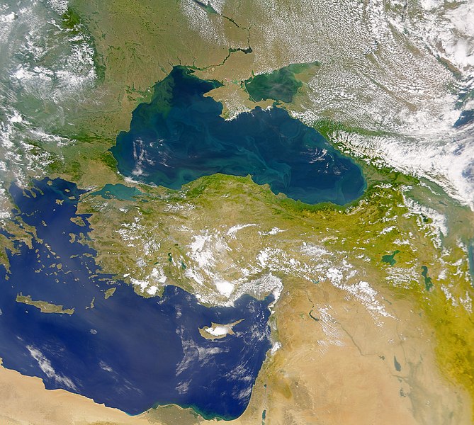
File:The Danube Spills into the Black Sea.jpg
外觀

預覽大小:669 × 600 像素。 其他解析度:268 × 240 像素 | 535 × 480 像素 | 857 × 768 像素 | 1,142 × 1,024 像素 | 2,080 × 1,865 像素。
原始檔案 (2,080 × 1,865 像素,檔案大小:1.07 MB,MIME 類型:image/jpeg)
檔案歷史
點選日期/時間以檢視該時間的檔案版本。
| 日期/時間 | 縮圖 | 尺寸 | 使用者 | 備註 | |
|---|---|---|---|---|---|
| 目前 | 2010年4月20日 (二) 11:20 |  | 2,080 × 1,865(1.07 MB) | Originalwana | {{Information |Description={{en|1=This cloud-free Sea-viewing Wide Field-of-view Sensor (SeaWiFS) view of the Black Sea reveals the colourful interplay of currents on the lake’s surface. The green crescent shaped pattern in the north-western cor |
檔案用途
全域檔案使用狀況
以下其他 wiki 使用了這個檔案:
- ady.wikipedia.org 的使用狀況
- crh.wikipedia.org 的使用狀況
- en.wikipedia.org 的使用狀況
- eo.wikipedia.org 的使用狀況
- fr.wikipedia.org 的使用狀況
- gl.wikipedia.org 的使用狀況
- gu.wikipedia.org 的使用狀況
- hak.wikipedia.org 的使用狀況
- hr.wikipedia.org 的使用狀況
- hu.wikipedia.org 的使用狀況
- ilo.wikipedia.org 的使用狀況
- ja.wikipedia.org 的使用狀況
- kn.wikipedia.org 的使用狀況
- ko.wikipedia.org 的使用狀況
- lg.wikipedia.org 的使用狀況
- pl.wikipedia.org 的使用狀況
- rm.wikipedia.org 的使用狀況
- sr.wikipedia.org 的使用狀況
- ta.wikipedia.org 的使用狀況
- uk.wikipedia.org 的使用狀況
- vi.wikipedia.org 的使用狀況
- wuu.wikipedia.org 的使用狀況
- zh-yue.wikipedia.org 的使用狀況


