
File:USACE Webbers Falls Lock and Dam.jpg
預覽大小:400 × 599 像素。 其他解析度:160 × 240 像素 | 320 × 480 像素 | 1,001 × 1,500 像素。
原始檔案 (1,001 × 1,500 像素,檔案大小:580 KB,MIME 類型:image/jpeg)
| 描述 |
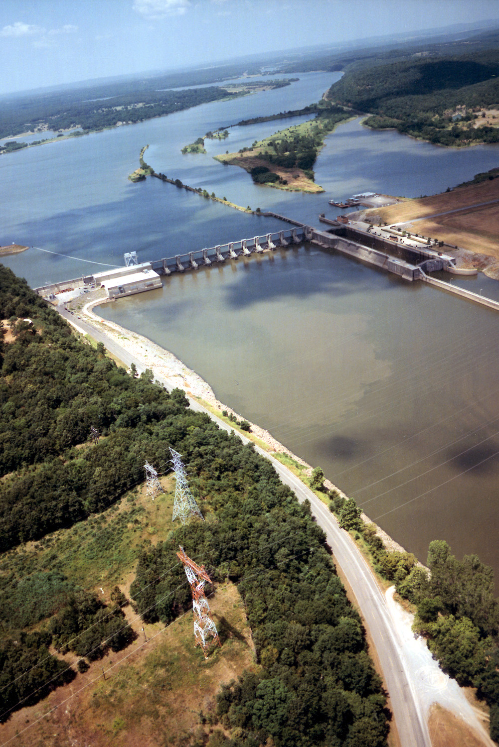
English: Aerial view of Webbers Falls Lock and Dam on the Arkansas River in Muskogee County, Oklahoma, USA. The dam is located about 4 miles (6.4 km) upriver from the town of Webbers Falls and about 62 miles (100 km) (straight line) southeast of Tulsa. The U.S. Army Corps of Engineers maintains the locks and the river channel for barge navigation on the river. View is upriver to the northwest.
Coordinates: 35°33′13.73″N 95°10′9.26″W / 35.5538139°N 95.1692389°W |
|||
| 圖中地點 | Muskogee County, Oklahoma, USA | |||
| 日期 | (Caveat: Dates provided by U.S. Army Corps of Engineers Digital Visual Library are not reliable and may be wrong.) | |||
| 來源 |
U.S. Army Corps of Engineers Digital Visual Library Image page Image description page Digital Visual Library home page |
|||
| 作者 | U.S. Army Corps of Engineers, photographer not specified or unknown | |||
| 授權許可 (重用此檔案) |
|
檔案歷史
點選日期/時間以檢視該時間的檔案版本。
| 日期/時間 | 縮圖 | 尺寸 | 使用者 | 備註 | |
|---|---|---|---|---|---|
| 目前 | 2007年5月11日 (五) 03:15 | | 1,001 × 1,500(580 KB) | DanMS | {{Information | Description = {{en|Aerial view of Webbers Falls Lock and Dam on the Arkansas River in Muskogee County, Oklahoma, USA. The dam is located about 4 miles (6.4 km) upriver from the town of Webbers Falls and about 62 miles (100 km) (straight |
檔案用途
下列2個頁面有用到此檔案:
全域檔案使用狀況
以下其他 wiki 使用了這個檔案:
- da.wikipedia.org 的使用狀況
- en.wikipedia.org 的使用狀況
- es.wikipedia.org 的使用狀況
- fr.wikipedia.org 的使用狀況
- ja.wikipedia.org 的使用狀況
- ky.wikipedia.org 的使用狀況
- pt.wikipedia.org 的使用狀況
- www.wikidata.org 的使用狀況