
File:United Kingdom United States Locator.svg

此 SVG 檔案的 PNG 預覽的大小:800 × 353 像素。 其他解析度:320 × 141 像素 | 640 × 283 像素 | 1,024 × 452 像素 | 1,280 × 565 像素 | 2,560 × 1,130 像素 | 940 × 415 像素。
原始檔案 (SVG 檔案,表面大小:940 × 415 像素,檔案大小:2.56 MB)
摘要
| 描述 |
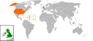
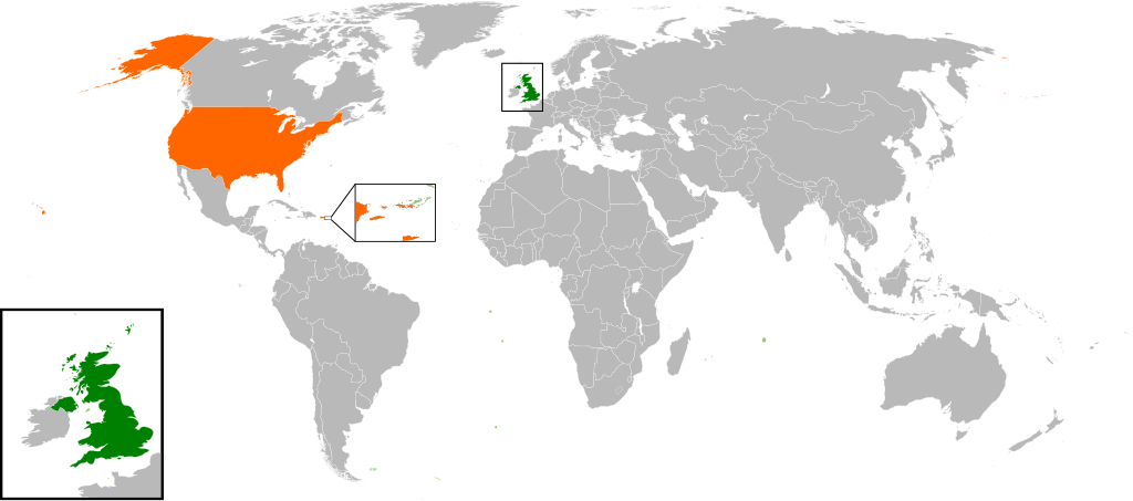
English: Map of the world showing the location of the United Kingdom and the United States of America. |
| 日期 | |
| 來源 | 自己的作品 |
| 作者 | Jolly Janner |
授權條款
| 我,此作品的版權所有人,釋出此作品至公共領域。此授權條款在全世界均適用。 這可能在某些國家不合法,如果是的話: 我授予任何人有權利使用此作品於任何用途,除受法律約束外,不受任何限制。 |
檔案歷史
點選日期/時間以檢視該時間的檔案版本。
| 日期/時間 | 縮圖 | 尺寸 | 使用者 | 備註 | |
|---|---|---|---|---|---|
| 目前 | 2017年3月20日 (一) 16:00 | | 940 × 415(2.56 MB) | RaviC | add dependencies, inset map for Virgin Islands region where both states share a maritime border |
| 2016年12月24日 (六) 02:43 |  | 940 × 415(1.79 MB) | BurritoBazooka | put all Faroe islands except Suðuroy region behind black border of UK box. Make two boxes (transparent group rectangle and white bg rectangle) same stroke thickness. | |
| 2016年12月24日 (六) 00:43 |  | 940 × 415(1.79 MB) | BurritoBazooka | add France and Faroe Islands to UK box by re-cutting it from its place on the map (b/c why should ROI, another sovereign state, be shown, and not France and the Faroe Islands?) Also the box has its own group now. | |
| 2016年12月24日 (六) 00:34 |  | 940 × 415(1.78 MB) | BurritoBazooka | French Polynesia, Pitcairn Islands were showing in the UK box, but these are not in the same area as the British Isles at all. Also, are Falklands etc not on the same level as Puerto Rico? | |
| 2016年12月7日 (三) 18:38 |  | 940 × 415(1.78 MB) | Mikey641 | Accident | |
| 2016年12月7日 (三) 18:38 |  | 512 × 226(753 KB) | Mikey641 | -- | |
| 2013年3月3日 (日) 18:09 |  | 940 × 415(1.78 MB) | Timothy Gu | +South Sudan (w/ small Britain map) | |
| 2012年3月2日 (五) 21:25 |  | 940 × 415(1.63 MB) | Jrobin08 | Reverted to version as of 20:37, 24 June 2009 (Easier to see the United Kingdom. Maybe someone can add South Sudan to the map, but keep the UK zoom box in.) | |
| 2011年9月23日 (五) 21:05 |  | 940 × 415(1.76 MB) | Bazonka2 | + South Sudan | |
| 2009年6月24日 (三) 20:37 |  | 940 × 415(1.63 MB) | Jolly Janner | {{Information |Description={{en|1=Map of the world showing the location of the United Kingdom and the United States of America.}} |Source=Own work by uploader |Author=Jolly Janner |Date=2009-0 |
檔案用途
下列頁面有用到此檔案:
全域檔案使用狀況
以下其他 wiki 使用了這個檔案:
- ar.wikipedia.org 的使用狀況
- ca.wikipedia.org 的使用狀況
- de.wikipedia.org 的使用狀況
- en.wikipedia.org 的使用狀況
- es.wikipedia.org 的使用狀況
- fr.wikipedia.org 的使用狀況
- he.wikipedia.org 的使用狀況
- hy.wikipedia.org 的使用狀況
- id.wikipedia.org 的使用狀況
- it.wikipedia.org 的使用狀況
- ja.wikipedia.org 的使用狀況
- ps.wikipedia.org 的使用狀況
- pt.wikipedia.org 的使用狀況
- ru.wikipedia.org 的使用狀況
- th.wikipedia.org 的使用狀況
- tr.wikipedia.org 的使用狀況
- uk.wikipedia.org 的使用狀況
- www.wikidata.org 的使用狀況