
File:Watersnoodramp 1953.jpg
預覽大小:746 × 600 像素。 其他解析度:299 × 240 像素 | 597 × 480 像素 | 955 × 768 像素 | 1,274 × 1,024 像素 | 2,548 × 2,048 像素 | 2,943 × 2,366 像素。
原始檔案 (2,943 × 2,366 像素,檔案大小:1.94 MB,MIME 類型:image/jpeg)
摘要
| 描述 |
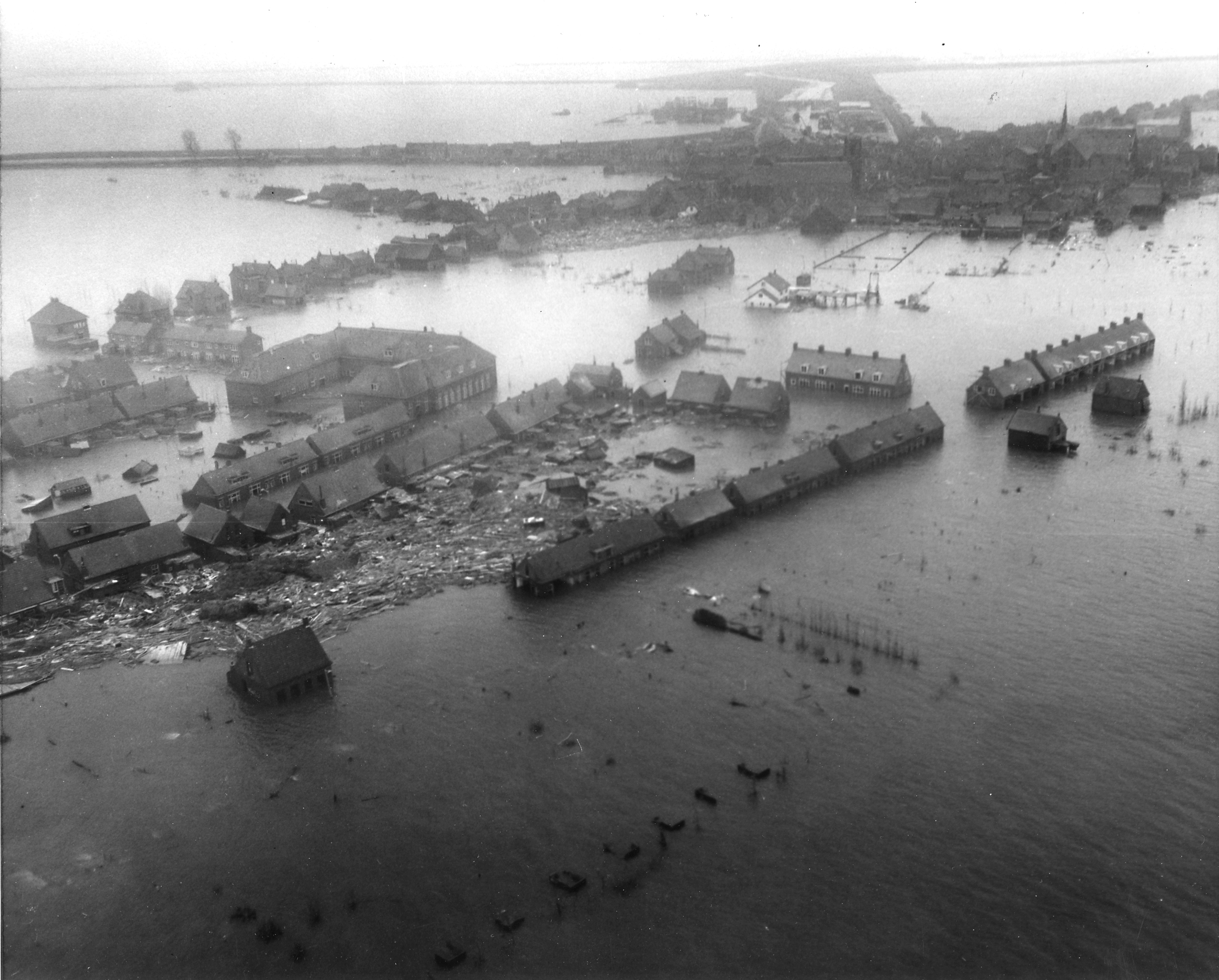
Nederlands: Luchtfoto van het overstroomde dorp Oude Tonge op Goeree-Overflakkee tijdens de Watersnoodramp van 1953. Foto gemaakt vanuit een U.S. Army helicopter.
English: Netherlands. Viewed from a U.S. Army helicopter, gives a hint of the tremendous damage wrought by the flood to Dutch islands. NB Original caption ("Zuid Beveland town") was a false determination of the location, it is actually Oude-Tonge on the island of Goeree-Overflakkee. |
|||
| 日期 | ||||
| 來源 |
|
|||
| 作者 | Agency for International Development |
授權條款
此作品在美國屬於公有領域,因為其是由美國政府的官員或僱員,基於其個人公務目的製作的作品,參考美國法典第17篇第1章第105條。
注意︰本模板僅適用於美國聯邦政府的原創作品,不適用於任何美國州、屬地、聯邦個體、縣、市或任何次級政府的作品。本模板也不適用於1978年以後由美國郵政署出版的郵票圖案(參看美國版權局實踐綱領第313.6(C)(1)條)。也不適用於部分美國硬幣;參看美國鑄幣局使用條款。 |
 | |
| 此作品無已知的著作權限制,亦不受所有相關和鄰接的權利限制。 | ||
檔案歷史
點選日期/時間以檢視該時間的檔案版本。
| 日期/時間 | 縮圖 | 尺寸 | 使用者 | 備註 | |
|---|---|---|---|---|---|
| 目前 | 2009年10月20日 (二) 23:36 | | 2,943 × 2,366(1.94 MB) | Pieter Kuiper | better resolution from http://narademo.umiacs.umd.edu/cgi-bin/isadg/viewobject.pl?object=78667 |
| 2008年8月16日 (六) 20:38 |  | 600 × 484(67 KB) | Pieter Kuiper | {{Information |Description={{en|1=Netherlands. Viewed from a U.S. Army helicopter, a Zuid Beveland town gives a hint of the tremendous damage wrought by the flood to Dutch islands.}} |Source=[http://www.archives.gov/ NARA], ARC Identifier 541705 / Local I |
檔案用途
下列頁面有用到此檔案:
全域檔案使用狀況
以下其他 wiki 使用了這個檔案:
- ar.wikipedia.org 的使用狀況
- arz.wikipedia.org 的使用狀況
- br.wikipedia.org 的使用狀況
- ca.wikipedia.org 的使用狀況
- cs.wikipedia.org 的使用狀況
- cy.wikipedia.org 的使用狀況
- de.wikipedia.org 的使用狀況
- en.wikipedia.org 的使用狀況
- eo.wikipedia.org 的使用狀況
- es.wikipedia.org 的使用狀況
- fa.wikipedia.org 的使用狀況
- fi.wikipedia.org 的使用狀況
- fr.wikipedia.org 的使用狀況
- fy.wikipedia.org 的使用狀況
- gl.wikipedia.org 的使用狀況
- he.wikipedia.org 的使用狀況
- hr.wikipedia.org 的使用狀況
- it.wikipedia.org 的使用狀況
- ja.wikipedia.org 的使用狀況
- ko.wikipedia.org 的使用狀況
- lv.wikipedia.org 的使用狀況
- ms.wikipedia.org 的使用狀況
檢視此檔案的更多全域使用狀況。