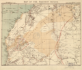
File:Western Sahara 1876.png

預覽大小:698 × 600 像素。 其他解析度:279 × 240 像素 | 559 × 480 像素 | 746 × 641 像素。
原始檔案 (746 × 641 像素,檔案大小:882 KB,MIME 類型:image/png)
檔案歷史
點選日期/時間以檢視該時間的檔案版本。
| 日期/時間 | 縮圖 | 尺寸 | 使用者 | 備註 | |
|---|---|---|---|---|---|
| 目前 | 2017年3月4日 (六) 08:36 |  | 746 × 641(882 KB) | Koavf | whitespace |
| 2017年3月3日 (五) 23:42 |  | 1,366 × 641(953 KB) | Kenzahurts | User created page with UploadWizard |
檔案用途
下列頁面有用到此檔案:
全域檔案使用狀況
以下其他 wiki 使用了這個檔案:
- ar.wikipedia.org 的使用狀況
- ca.wikipedia.org 的使用狀況
- cs.wikipedia.org 的使用狀況
- en.wikipedia.org 的使用狀況
- eo.wikipedia.org 的使用狀況
- es.wikipedia.org 的使用狀況
- it.wikipedia.org 的使用狀況
- ja.wikipedia.org 的使用狀況
- pt.wikipedia.org 的使用狀況
- ru.wikipedia.org 的使用狀況
- te.wikipedia.org 的使用狀況
- th.wikipedia.org 的使用狀況
- uk.wikipedia.org 的使用狀況

