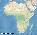
File:Africa land cover location map.jpg
外觀

預覽大小:635 × 600 像素。 其他解析度:254 × 240 像素 | 508 × 480 像素 | 813 × 768 像素 | 1,084 × 1,024 像素 | 1,525 × 1,440 像素。
原始檔案 (1,525 × 1,440 像素,檔案大小:523 KB,MIME 類型:image/jpeg)
檔案歷史
點選日期/時間以檢視該時間的檔案版本。
| 日期/時間 | 縮圖 | 尺寸 | 用戶 | 備註 | |
|---|---|---|---|---|---|
| 目前 | 2011年7月14日 (四) 18:54 |  | 1,525 × 1,440(523 KB) | Sting | Sudan/South Sudan 07-2011 border update |
| 2010年7月19日 (一) 13:33 |  | 1,525 × 1,440(440 KB) | Sting | Color profile | |
| 2010年7月7日 (三) 02:55 |  | 1,525 × 1,440(447 KB) | Sting | Again... | |
| 2010年7月7日 (三) 02:49 |  | 1,525 × 1,440(441 KB) | Sting | Public domain => no copyright mention | |
| 2010年7月3日 (六) 20:29 |  | 1,525 × 1,440(447 KB) | Sting | == {{int:filedesc}} == {{Location|00|00|00|N|15|00|00|E|scale:30000000}} <br/>{{Information |Description={{en|Land cover map of Africa simulating the natural aspect of the land with bathymetry; for geo-location purposes.} |
檔案用途
沒有使用此檔案的頁面。
全域檔案使用狀況
以下其他 wiki 使用了這個檔案:
- als.wikipedia.org 的使用狀況
- ar.wikipedia.org 的使用狀況
- az.wikipedia.org 的使用狀況
- ce.wikipedia.org 的使用狀況
- de.wikipedia.org 的使用狀況
- en.wikipedia.org 的使用狀況
- frr.wikipedia.org 的使用狀況
- fr.wikipedia.org 的使用狀況
- hr.wikipedia.org 的使用狀況
- Predložak:Klikabilna mapa start
- Predložak:Etnička karta/BiH/Fojnica
- Predložak:Etnička karta/BiH/Prozor-Rama
- Predložak:Etnička karta/BiH/Uskoplje
- Suradnik:Sombrero/sandbox
- Predložak:Etnička karta/BiH/Konjic
- Predložak:Etnička karta/BiH/Jablanica
- Predložak:Etnička karta/BiH/Kreševo
- Predložak:Etnička karta/BiH/Kupres
- Predložak:Etnička karta/BiH/Bugojno
- Predložak:Etnička karta/BiH/Brčko
- Modul:Location map
- Predložak:Location map
- Modul:Location map/data/Afrika
- Modul:Location map/doc
- Predložak:Location map/doc
- Modul:Location map/data/Afrika/doc
- inh.wikipedia.org 的使用狀況
- lv.wikipedia.org 的使用狀況
- mn.wikipedia.org 的使用狀況
- myv.wikipedia.org 的使用狀況
- pt.wikipedia.org 的使用狀況
- ru.wikipedia.org 的使用狀況
- si.wikipedia.org 的使用狀況
檢視此檔案的更多全域使用狀況。


