
File:C A Thayer.JPG
此為最大尺寸。
C_A_Thayer.JPG (161 × 225 像素,檔案大小:32 KB,MIME 類型:image/jpeg)
| 描述 |
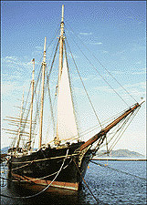
English: Photograph of the C.A. Thayer |
| 來源 | from NPS website |
| 作者 | See below |
| 目標地點 | | 位於此地的本圖片與其他圖片: OpenStreetMap |
|---|
授權條款
| This image or media file contains material based on a work of a National Park Service employee, created as part of that person's official duties. As a work of the U.S. federal government, such work is in the public domain in the United States. See the NPS website and NPS copyright policy for more information. |
原始上傳日誌
Transferred from en.wikipedia to Commons by Allen4names using CommonsHelper.
The original description page was here. All following user names refer to en.wikipedia.
- 2006-02-14 10:22 Ctdunstan 161×225× (32839 bytes) from [http://www.nps.gov/safr/local/thayer.html NPS website]
檔案歷史
點選日期/時間以檢視該時間的檔案版本。
| 日期/時間 | 縮圖 | 尺寸 | 用戶 | 備註 | |
|---|---|---|---|---|---|
| 目前 | 2010年2月23日 (二) 02:11 | | 161 × 225(32 KB) | Allen4names | {{Information |Description={{en|Photograph of the C.A. Thayer}} |Source=Transferred from [http://en.wikipedia.org en.wikipedia]; transferred to Commons by User:Allen4names using [http://tools.wikimedia.de/~magnus/commonshelp |
檔案用途
下列頁面有用到此檔案:
全域檔案使用狀況
以下其他 wiki 使用了這個檔案:
- de.wikipedia.org 的使用狀況
- en.wikipedia.org 的使用狀況
- San Francisco Maritime National Historical Park
- C.A. Thayer (1895)
- User:Ctdunstan
- National Register of Historic Places listings in San Francisco
- List of National Historic Landmarks in California
- List of U.S. National Historic Landmark ships, shipwrecks, and shipyards
- List of large sailing vessels
- Hans Ditlev Bendixsen
- fr.wikipedia.org 的使用狀況
- nl.wikipedia.org 的使用狀況
- no.wikipedia.org 的使用狀況
- pt.wikipedia.org 的使用狀況
- ru.wikipedia.org 的使用狀況