
File:Colonisation2.gif

預覽大小:799 × 350 像素。 其他解析度:320 × 140 像素 | 640 × 280 像素 | 1,024 × 449 像素 | 1,849 × 810 像素。
原始檔案 (1,849 × 810 像素,檔案大小:2.08 MB,MIME 類型:image/gif、循環、12 畫格、48秒)
摘要
| 描述 |
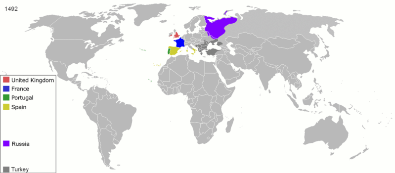
English: Map indicating the territories colonized by the European powers, United States and Japan.
Русский: Карта с указанием территорий, колонизированных Европейскими державами, Соединёнными штатами и Японией.
|
||||||||||||||||
| 日期 | 2008年六月23日 (原始上傳日期) | ||||||||||||||||
| 來源 | Transferred from en.wikipedia to Commons. | ||||||||||||||||
| 作者 | 英文維基百科的ArdadN | ||||||||||||||||
| 其他版本 |
The maps can be seen separately by using this template:
Derivative works of this file: |
||||||||||||||||
.gif)
.jpg)
._LOC_2001620596.jpg)
授權條款
| 我,此作品的版權所有人,釋出此作品至公共領域。此授權條款在全世界均適用。 這可能在某些國家不合法,如果是的話: 我授予任何人有權利使用此作品於任何用途,除受法律約束外,不受任何限制。 |
檔案歷史
點選日期/時間以檢視該時間的檔案版本。
| 日期/時間 | 縮圖 | 尺寸 | 用戶 | 備註 | |
|---|---|---|---|---|---|
| 目前 | 2020年10月5日 (一) 15:40 | | 1,849 × 810(2.08 MB) | Ориенталист | Colour correction |
| 2020年5月10日 (日) 14:19 |  | 800 × 379(606 KB) | Ориенталист | Cosmetic changes | |
| 2020年4月5日 (日) 09:39 |  | 800 × 351(561 KB) | Ориенталист | Last time i forgot 1914. Аdded it, little changes | |
| 2020年4月4日 (六) 09:49 |  | 800 × 351(495 KB) | Ориенталист | Changed maps for 1492, 1550, 1660, 1754. Added a map for 1600. | |
| 2019年1月9日 (三) 11:29 |  | 1,425 × 625(101 KB) | ArdadN | fixed Ireland 1754, Morocco 1914, Russian-German border 1885 and 1914, German-French border 1885 and 1914, German-Danish border 1885, Austria and Sudetenland 1938 | |
| 2018年7月23日 (一) 08:54 |  | 1,425 × 625(101 KB) | SuperSucker | fix - believe in 1938 ethiopia was under european occupation as well.. italy had taken the capital Addis-Abeba in 1936 indeed | |
| 2012年6月4日 (一) 20:27 |  | 1,425 × 625(101 KB) | Mnlk | i corrected the error that falsly depicted ethiopia as colony of fascist italy | |
| 2011年2月19日 (六) 19:49 |  | 1,425 × 625(246 KB) | NordNordWest | corrected according to http://de.wikipedia.org/w/index.php?title=Benutzer_Diskussion%3ANordNordWest&action=historysubmit&diff=85468547&oldid=85447379 | |
| 2011年2月18日 (五) 19:40 |  | 1,425 × 625(236 KB) | NordNordWest | corrected according to http://de.wikipedia.org/w/index.php?title=Benutzer_Diskussion%3ANordNordWest&action=historysubmit&diff=85447379&oldid=85351900 | |
| 2010年9月16日 (四) 19:42 |  | 1,425 × 625(257 KB) | NordNordWest | further corrections |
檔案用途
下列3個頁面有用到此檔案:
全域檔案使用狀況
以下其他 wiki 使用了這個檔案:
- ar.wikipedia.org 的使用狀況
- av.wikipedia.org 的使用狀況
- azb.wikipedia.org 的使用狀況
- az.wikipedia.org 的使用狀況
- ba.wikipedia.org 的使用狀況
- be-tarask.wikipedia.org 的使用狀況
- be.wikipedia.org 的使用狀況
- bg.wikipedia.org 的使用狀況
- bn.wikipedia.org 的使用狀況
- ce.wikipedia.org 的使用狀況
- cs.wikipedia.org 的使用狀況
- da.wikipedia.org 的使用狀況
- de.wikipedia.org 的使用狀況
- diq.wikipedia.org 的使用狀況
- en.wikipedia.org 的使用狀況
- History of Europe
- Early modern period
- Maritime history
- Colonial empire
- History of colonialism
- User:Palaeovia
- Portal:Maps/Maps/World
- Portal:Maps/Maps/World/18
- History of globalization
- User talk:AtomAtom
- Western world
- User:Meclee/proj4-sandbox
- User:Kazkaskazkasako/Books/History
- Outline of globalization
- Decoloniality
- Wikipedia:Graphics Lab/Map workshop/Archive/Apr 2014
- User:Bongan
- User:Bongan/genetic history of the human race
- en.wikibooks.org 的使用狀況
檢視此檔案的更多全域使用狀況。