
File:Europa 1890.jpg

預覽大小:766 × 599 像素。 其他解析度:307 × 240 像素 | 614 × 480 像素 | 982 × 768 像素 | 1,280 × 1,001 像素 | 2,500 × 1,956 像素。
原始檔案 (2,500 × 1,956 像素,檔案大小:1.84 MB,MIME 類型:image/jpeg)
摘要
| 描寫文 |
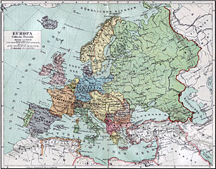
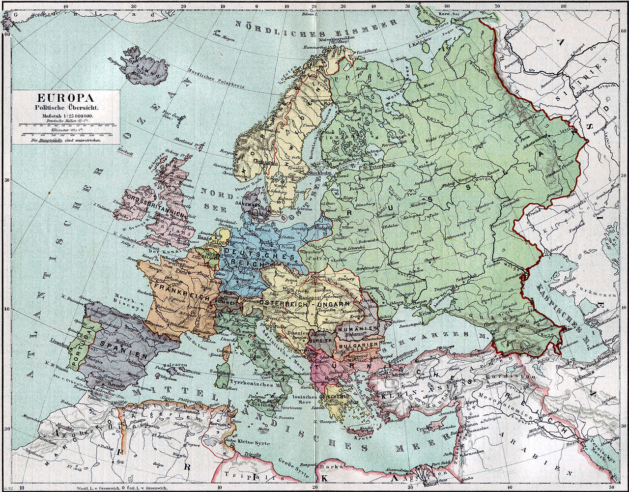
Politische Karte Europas ca. 1890 |
|||||
| 日期 | ||||||
| 來源 | Meyers Kleines Konversationslexikon. Fünfte, umgearbeitete und vermehrte Auflage. Bd. 1. Bibliographisches Institut, Leipzig und Wien 1892. | |||||
| 創作作者 |
unbekannt, scan by sidonius 15:36, 7 November 2006 (UTC) |
|||||
| 授權許可 (重用此檔案) |
|
|||||
| 地理參考 | 如果不合適,請設定「warp_status = skip」為隱藏。 | |||||
| 其他版本 | Derivative works of this file: Blank map of Europe 1890.svg |

_en.png)
.png)
.jpg)
檔案歷史
點選日期/時間以檢視該時間的檔案版本。
| 日期/時間 | 縮圖 | 尺寸 | 用戶 | 備註 | |
|---|---|---|---|---|---|
| 目前 | 2006年11月7日 (二) 15:36 | | 2,500 × 1,956(1.84 MB) | Sidonius | {{Information |Description=Politische Karte Europas ca. 1890 |Source=Meyers Kleines Konversationslexikon. Fünfte, umgearbeitete und vermehrte Auflage. Bd. 1. Bibliographisches Institut, Leipzig und Wien 1892. |Date=1892 |Author=unbekannt, |
檔案用途
沒有使用此檔案的頁面。
全域檔案使用狀況
以下其他 wiki 使用了這個檔案:
- bn.wikipedia.org 的使用狀況
- de.wikipedia.org 的使用狀況
- de.wikibooks.org 的使用狀況
- en.wikipedia.org 的使用狀況
- et.wikipedia.org 的使用狀況
- fa.wikipedia.org 的使用狀況
- fr.wikipedia.org 的使用狀況
- hu.wikipedia.org 的使用狀況
- it.wikipedia.org 的使用狀況
- mk.wikipedia.org 的使用狀況
- pl.wikipedia.org 的使用狀況
- pnb.wikipedia.org 的使用狀況
- sa.wikipedia.org 的使用狀況
- scn.wikipedia.org 的使用狀況
- skr.wikipedia.org 的使用狀況
- uk.wikipedia.org 的使用狀況
- ur.wikipedia.org 的使用狀況