
File:Haiyan 2013-11-07 1800Z surface analysis.png

預覽大小:600 × 600 像素。 其他解析度:240 × 240 像素 | 480 × 480 像素 | 768 × 768 像素 | 1,024 × 1,024 像素 | 2,000 × 2,000 像素。
原始檔案 (2,000 × 2,000 像素,檔案大小:193 KB,MIME 類型:image/png)
摘要
| 描述 |
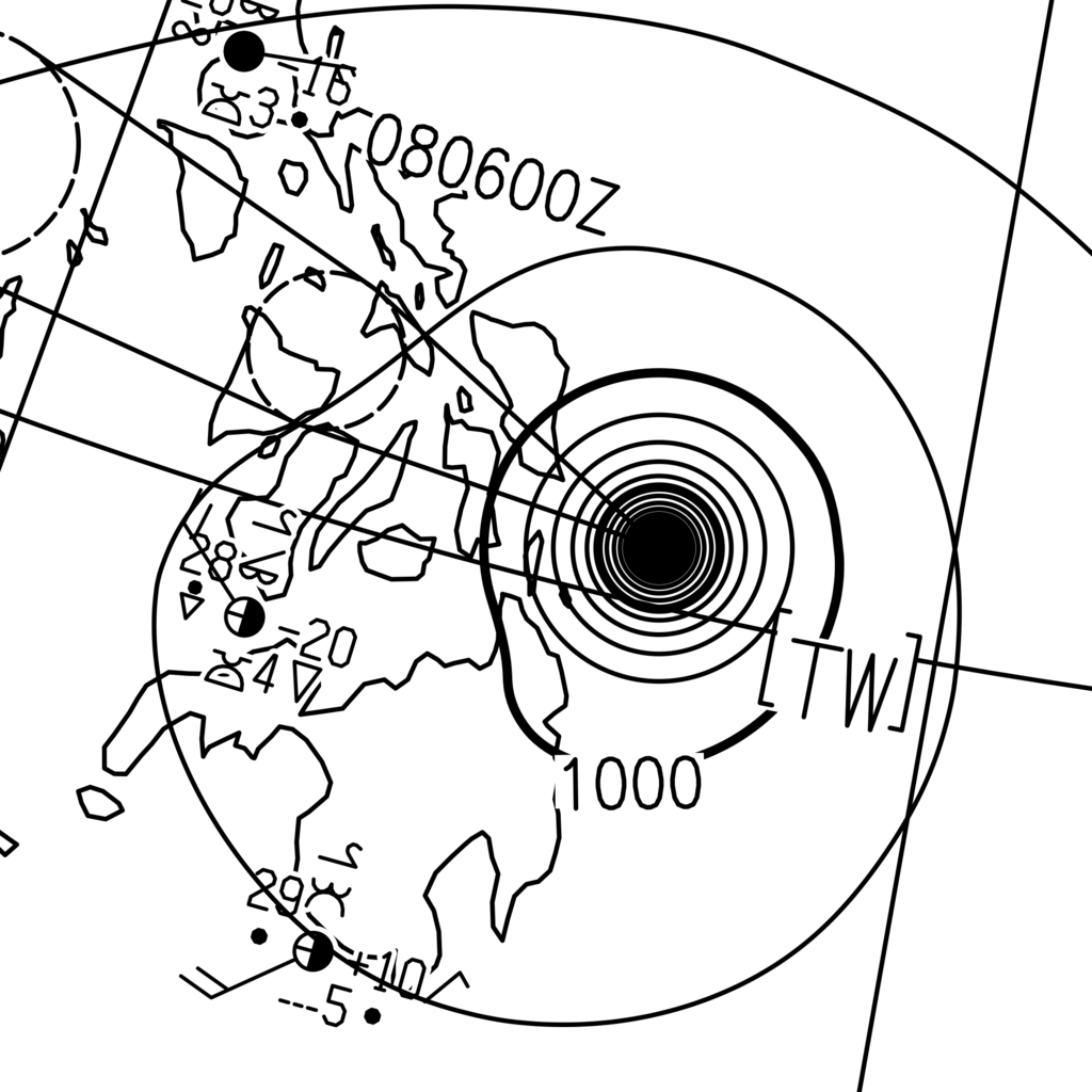
English: The surface analysis of Typhoon Haiyan on 8 November 2013 at 02:00 Philippine Standard Time (on 7 November 2013 at 18:00 Coordinated Universal Time), released the by Japan Meteorological Agency. The central pressure, which is not labeled over Haiyan on the image, was 895 hPa. |
| 日期 | |
| 來源 | http://www.jma.go.jp/jp/g3/images/asia/pdf/asas.pdf |
| 作者 | The Japan Meteorological Agency |
| 拍攝地點 | | 位於此地的本圖片與其他圖片: OpenStreetMap |
|---|
授權條款
This image was produced by the 氣象廳. The legal notice (archive) stated that all the images published on their website is compatible with the Creative Commons Attribution 4.0 License, which means that all the images on this website is published under the Creative Commons Attribution 4.0 License unless otherwise specified.
此檔案採用創用CC 姓名標示 4.0 國際授權條款。 姓名標示: 氣象廳
|
 |

檔案歷史
點選日期/時間以檢視該時間的檔案版本。
| 日期/時間 | 縮圖 | 尺寸 | 用戶 | 備註 | |
|---|---|---|---|---|---|
| 目前 | 2015年1月4日 (日) 05:24 | | 2,000 × 2,000(193 KB) | Meow | Doubled the width and height. |
| 2015年1月4日 (日) 04:49 |  | 1,000 × 1,000(93 KB) | Meow | User created page with UploadWizard |
檔案用途
沒有使用此檔案的頁面。