
File:Kuk New Guinea 2002.jpg

預覽大小:758 × 600 像素。 其他解析度:303 × 240 像素 | 607 × 480 像素 | 971 × 768 像素 | 1,280 × 1,013 像素 | 2,560 × 2,026 像素 | 2,664 × 2,108 像素。
原始檔案 (2,664 × 2,108 像素,檔案大小:1.27 MB,MIME 類型:image/jpeg)
摘要
| 描述 |
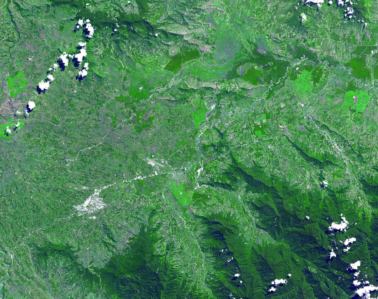
English: The Kuk Early Agricultural Site consists of 116 ha of swamps in the western highlands of New Guinea 1,500 meters above sea-level. Archaeological excavation has revealed the landscape to be one of wetland reclamation worked almost continuously for 7,000, and possibly for 10,000 years. The area was declared a UNESCO World Heritage Site in 2008. The image was acquired May 7, 2002, covers an area of 31.6 x 40 km, and is located at 5.8° S, 144.3° E. |
| 日期 | |
| 來源 | http://photojournal.jpl.nasa.gov/catalog/PIA13090 |
| 作者 | NASA: JPL |
授權條款
| 本作品由NASA創作,屬於公有領域。根據NASA的版權政策:“NASA的創作除非另有聲明否則不受版權保護。”(參見:Template:PD-USGov/zh,NASA版權政策或JPL圖像使用政策) | ||
 |
警告:
|
檔案歷史
點選日期/時間以檢視該時間的檔案版本。
| 日期/時間 | 縮圖 | 尺寸 | 用戶 | 備註 | |
|---|---|---|---|---|---|
| 目前 | 2010年5月20日 (四) 02:54 | | 2,664 × 2,108(1.27 MB) | Elekhh | {{Information |Description={{en|1=The Kuk Early Agricultural Site consists of 116 ha of swamps in the western highlands of New Guinea 1,500 meters above sea-level. Archaeological excavation has revealed the landsca |
檔案用途
下列頁面有用到此檔案:
全域檔案使用狀況
以下其他 wiki 使用了這個檔案:
- af.wikipedia.org 的使用狀況
- ar.wikipedia.org 的使用狀況
- ast.wikipedia.org 的使用狀況
- be.wikipedia.org 的使用狀況
- ca.wikipedia.org 的使用狀況
- cs.wikipedia.org 的使用狀況
- de.wikipedia.org 的使用狀況
- de.wikivoyage.org 的使用狀況
- en.wikipedia.org 的使用狀況
- es.wikipedia.org 的使用狀況
- fa.wikipedia.org 的使用狀況
- fr.wikipedia.org 的使用狀況
- fr.wikivoyage.org 的使用狀況
- gl.wikipedia.org 的使用狀況
- he.wikipedia.org 的使用狀況
- he.wikivoyage.org 的使用狀況
- hr.wikipedia.org 的使用狀況
- hy.wikipedia.org 的使用狀況
- id.wikipedia.org 的使用狀況
- it.wikipedia.org 的使用狀況
- it.wikivoyage.org 的使用狀況
- ja.wikipedia.org 的使用狀況
- ka.wikipedia.org 的使用狀況
- kk.wikipedia.org 的使用狀況
- la.wikipedia.org 的使用狀況
- lt.wikipedia.org 的使用狀況
- lv.wikipedia.org 的使用狀況
檢視此檔案的更多全域使用狀況。