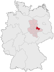
File:Lage des Landkreises Anhalt-Zerbst in Deutschland.png
外觀
Lage_des_Landkreises_Anhalt-Zerbst_in_Deutschland.png (176 × 234 像素,檔案大小:5 KB,MIME 類型:image/png)
檔案歷史
點選日期/時間以檢視該時間的檔案版本。
| 日期/時間 | 縮圖 | 尺寸 | 用戶 | 備註 | |
|---|---|---|---|---|---|
| 目前 | 2006年3月1日 (三) 12:35 |  | 176 × 234(5 KB) | Tsca.bot | Karte erstellt auf der Grundlage der opengeodb.de-Umrisse - GNU-FDL Moved from http://de.wikipedia.org {{GFDL}} Category:Maps of Germany |
檔案用途
下列頁面有用到此檔案:
全域檔案使用狀況
以下其他 wiki 使用了這個檔案:
- de.wikipedia.org 的使用狀況
- en.wikipedia.org 的使用狀況
- es.wikipedia.org 的使用狀況
- it.wikipedia.org 的使用狀況
- ka.wikipedia.org 的使用狀況
- kk.wikipedia.org 的使用狀況
- nl.wikipedia.org 的使用狀況
- pl.wikipedia.org 的使用狀況
- pt.wikipedia.org 的使用狀況
- www.wikidata.org 的使用狀況


