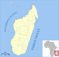
File:Madagascar range map template.svg
外觀

此 SVG 檔案的 PNG 預覽的大小:424 × 600 像素。 其他解析度:170 × 240 像素 | 339 × 480 像素 | 543 × 768 像素 | 724 × 1,024 像素 | 1,448 × 2,048 像素 | 744 × 1,052 像素。
原始檔案 (SVG 檔案,表面大小:744 × 1,052 像素,檔案大小:566 KB)
檔案歷史
點選日期/時間以檢視該時間的檔案版本。
| 日期/時間 | 縮圖 | 尺寸 | 用戶 | 備註 | |
|---|---|---|---|---|---|
| 目前 | 2015年3月4日 (三) 18:58 |  | 744 × 1,052(566 KB) | Maky | minor tweak: thicker border on the Comoros |
| 2015年2月18日 (三) 22:22 |  | 744 × 1,052(566 KB) | Maky | minor tweaks | |
| 2015年1月31日 (六) 05:08 |  | 744 × 1,052(513 KB) | Maky | new map from QGIS (more accurate and easier to update using QGIS and SHP files from the IUCN Red List) | |
| 2010年2月16日 (二) 07:06 |  | 452 × 533(448 KB) | Maky | removed text and condensed map | |
| 2009年8月3日 (一) 15:06 |  | 545 × 533(581 KB) | Maky | font change for display | |
| 2009年8月2日 (日) 17:41 |  | 545 × 533(581 KB) | Maky | fixed some font problems by converting paths to objects | |
| 2009年8月2日 (日) 17:12 |  | 545 × 533(506 KB) | Maky | improved scale; added legend, compass, and island names | |
| 2008年11月1日 (六) 07:20 |  | 545 × 533(493 KB) | Maky | {{Information |Description= |Source= |Date= |Author= |Permission= |other_versions= }} | |
| 2008年10月30日 (四) 23:07 |  | 650 × 520(1.91 MB) | Jackaranga | replacing png image by svg | |
| 2008年10月30日 (四) 21:35 |  | 650 × 520(595 KB) | Maky | {{Information |Description= |Source= |Date= |Author= |Permission= |other_versions= }} |
檔案用途
沒有使用此檔案的頁面。
全域檔案使用狀況
以下其他 wiki 使用了這個檔案:
- en.wikipedia.org 的使用狀況
- id.wikipedia.org 的使用狀況
- ru.wikipedia.org 的使用狀況


