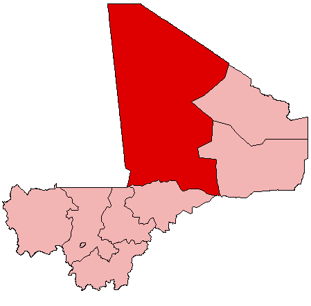
File:Mali Tombouctou.png
外觀
Mali_Tombouctou.png (449 × 443 像素,檔案大小:5 KB,MIME 類型:image/png)
檔案歷史
點選日期/時間以檢視該時間的檔案版本。
| 日期/時間 | 縮圖 | 尺寸 | 用戶 | 備註 | |
|---|---|---|---|---|---|
| 目前 | 2008年11月13日 (四) 09:57 |  | 449 × 443(5 KB) | YoaR~commonswiki | {{Information |Description={{en|Map of Mali showing Tombouctou Region; created with the GIMP. Made by en:User:Acntx.}} |Source=Transferred from [http://en.wikipedia.org en.wikipedia] |Date=2005-07-31 (original upload date) |Author=Original uploader w |
檔案用途
下列47個頁面有用到此檔案:
全域檔案使用狀況
以下其他 wiki 使用了這個檔案:
- ar.wikipedia.org 的使用狀況
- en.wikipedia.org 的使用狀況
- Timbuktu
- Diré
- Tombouctou Region
- Gossi
- Gargando
- Essakane
- Goundam
- Timbuktu Airport
- Silla, Mali
- Goundam Airport
- Goundam Cercle
- Wikipedia:WikiProject Mali/Regional commune templates
- Template:Communes of the Tombouctou Region
- Diré Cercle
- Gourma-Rharous Cercle
- Niafunké Cercle
- Timbuktu Cercle
- Template:Tombouctou-geo-stub
- Niafunké
- Arham
- Bourem Sidi Amar
- Dangha
- Garbakoïra
- Haibongo
- Kirchamba
- Kondi
- Sareyamou
- Tienkour
- Tindirma
- Bintagoungou
- Douékiré
- Adarmalane
- Kaneye
- Doukouria
- M'Bouna
- Raz El Ma
- Tin Aicha
- Tonka, Tombouctou Region
- Gourma-Rharous
- Bambara Maoudé
- Banikane, Gourma-Rharous
- Inadiatafane
- Koumaira
- Léré, Mali
- Dianke
- N'Gorkou
- Soumpi
- Soboundou
- Banikane Narhawa
檢視此檔案的更多全域使用狀況。


