
File:Map of Shanghai Pudong New District.png
預覽大小:509 × 599 像素。 其他解析度:204 × 240 像素 | 408 × 480 像素 | 652 × 768 像素 | 870 × 1,024 像素 | 1,600 × 1,884 像素。
原始檔案 (1,600 × 1,884 像素,檔案大小:2.43 MB,MIME 類型:image/png)
摘要
| 描述 |
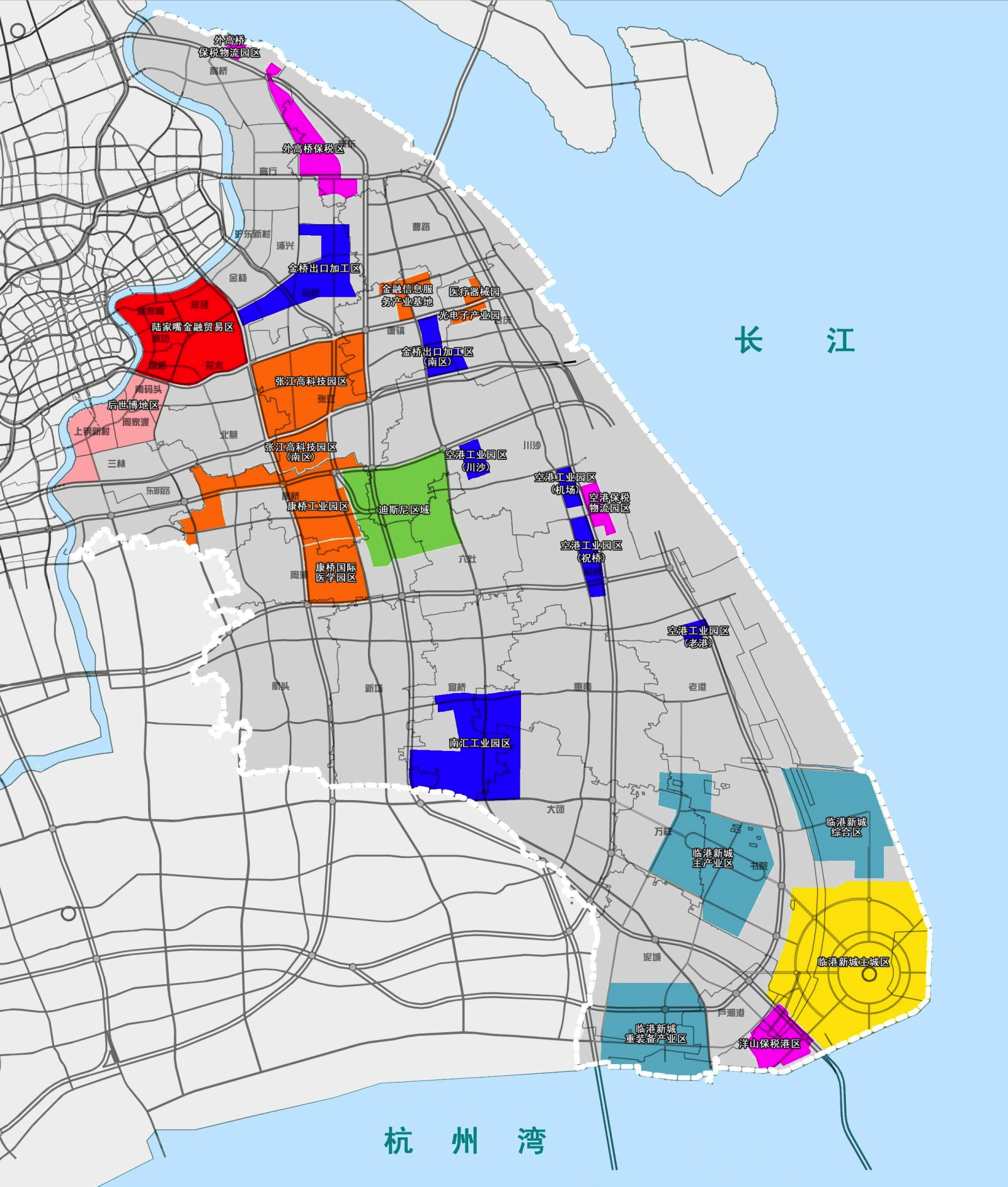
中文(中国大陆):上海市浦东新区人民政府发布的地图 English: A Chinese-language map of Pudong New Area (gray) with various neighborhoods and free trade zones in different colors: 2010 Expo Site (pink), Lujiazui (crimson), Jinqiao and Chuansha and Nanhui and Laogang (blue), Zhangjiang Hi-Tech Park (orange), Waigaoqiao and Pudong's area of Yangshan (hot pink), &c. Includes the recent Shanghai Yangtze Tunnel and Bridge to Chongming County, but Pudong's own Jiuduansha Shoals omitted. Includes proposed infrastructures projects which have not been undertaken, such as the bridge connecting Changxing and Hengsha Islands. |
| 日期 | |
| 來源 | http://gov.pudong.gov.cn/govOpenSRWJHGHSYW/Info/Detail_355191.htm |
| 作者 | 上海市浦东新区人民政府 |
授權條款
根據《中華人民共和國著作權法》第五條,本法不適用於:
|
 | |
|
本作品屬於上述條款,並在中國大陸和該法律其他的可能管轄區,屬於公有領域。對於著作權過期的作品,參見{{PD-China}}、{{PD-PRC}}。 | ||
檔案歷史
點選日期/時間以檢視該時間的檔案版本。
| 日期/時間 | 縮圖 | 尺寸 | 用戶 | 備註 | |
|---|---|---|---|---|---|
| 目前 | 2013年7月29日 (一) 18:01 | | 1,600 × 1,884(2.43 MB) | Yhz1221 | User created page with UploadWizard |
檔案用途
下列頁面有用到此檔案: