
File:Nanking & Chin-Keang-foo.jpg

預覽大小:800 × 464 像素。 其他解析度:320 × 185 像素 | 640 × 371 像素 | 1,024 × 593 像素 | 1,280 × 742 像素 | 2,560 × 1,484 像素 | 3,679 × 2,132 像素。
原始檔案 (3,679 × 2,132 像素,檔案大小:767 KB,MIME 類型:image/jpeg)
摘要
| 描述 |
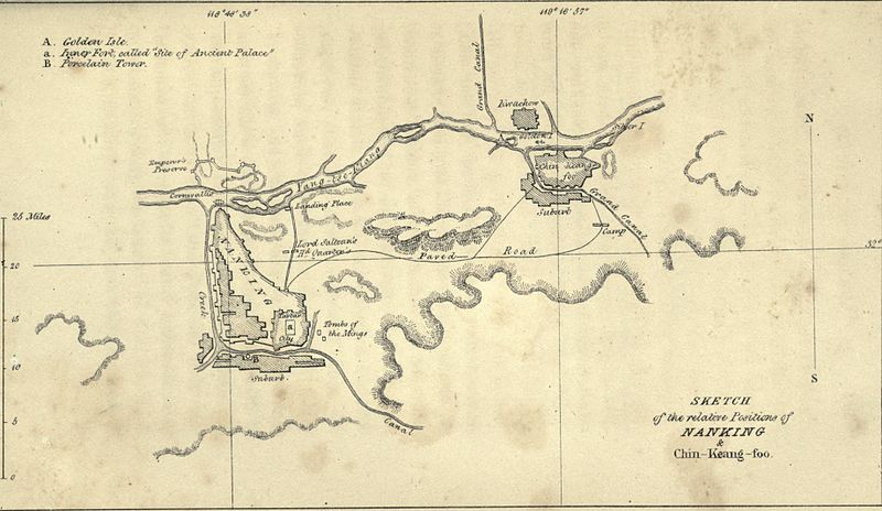
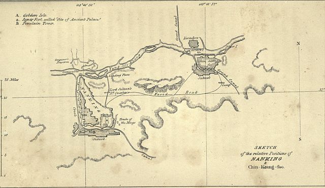
English: Sketch of the relative positions of Nanking and Chin-Keang-foo.
|
||||
| 日期 | published 1844 | ||||
| 來源 | John Ouchterlony (1844). The Chinese War. London: Saunders and Otley. p. 484. | ||||
| 作者 | "Drawn on stone by Hullmandel", p. xx | ||||
| 授權許可 (重用此檔案) |
|
||||
檔案歷史
點選日期/時間以檢視該時間的檔案版本。
| 日期/時間 | 縮圖 | 尺寸 | 用戶 | 備註 | |
|---|---|---|---|---|---|
| 目前 | 2010年8月14日 (六) 14:54 | | 3,679 × 2,132(767 KB) | Spellcast | == {{int:filedesc}} == {{Information |Description=Sketch of the relative positions of Nanking and Chin-Keang-foo. |Date=Published 1844 |Source=John Ouchterlony (1844). ''[http://www.archive.org/stream/chinesewaraccoun00ouchrich#page/570 The Chinese War]'' |
檔案用途
下列頁面有用到此檔案:
全域檔案使用狀況
以下其他 wiki 使用了這個檔案:
- ru.wikipedia.org 的使用狀況
- www.wikidata.org 的使用狀況