
File:Ngorongoro topo.jpg
原始檔案 (1,061 × 1,061 像素,檔案大小:471 KB,MIME 類型:image/jpeg)
摘要
| 描述 |
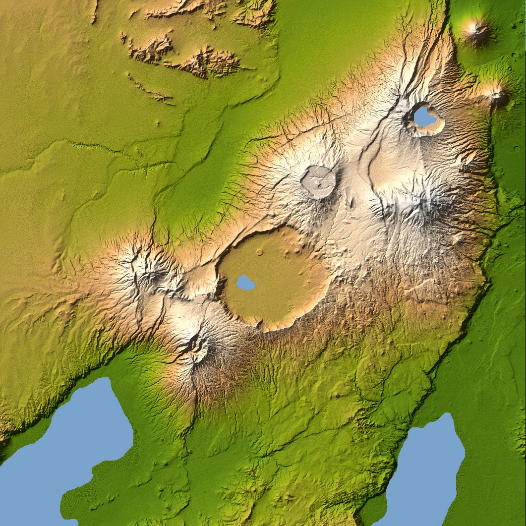
Ngorongoro’s caldera is 22.5 kilometers (14 miles) across at its widest point and is 610 meters (2,000 feet) deep. Its floor is very level, holding a lake fed by streams running down the caldera wall. It is part of the Ngorongoro Conservation Area and is home to over 75,000 animals. The lakes south of the crater are Lake Eyasi and Lake Manyara, also part of the conservation area. Orientation: North toward the top, Mercator projection Image Data: shaded and colored SRTM elevation model. The shade image was derived by computing topographic slope in the northwest-southeast direction, so that northwest slopes appear bright and southeast slopes appear dark. Color coding is directly related to topographic height, with green at the lower elevations, rising through yellow and tan, to white at the highest elevations. Date Acquired: February 2000 |
| 日期 | |
| 來源 | NASA Earth Observatory, Topography of Olduvai Gorge, East Africa (Outcut) |
| 作者 | NASA |
授權條款
| 本作品由NASA創作,屬於公有領域。根據NASA的版權政策:“NASA的創作除非另有聲明否則不受版權保護。”(參見:Template:PD-USGov/zh,NASA版權政策或JPL圖像使用政策) | ||
 |
警告:
|
檔案歷史
點選日期/時間以檢視該時間的檔案版本。
| 日期/時間 | 縮圖 | 尺寸 | 用戶 | 備註 | |
|---|---|---|---|---|---|
| 目前 | 2005年12月27日 (二) 18:56 | | 1,061 × 1,061(471 KB) | Lotse | ==Description== Ngorongoro’s caldera is 22.5 kilometers (14 miles) across at its widest point and is 610 meters (2,000 feet) deep. Its floor is very level, holding a lake fed by streams running down the caldera wall. It is part of the Ngorongoro Conserv |
檔案用途
下列頁面有用到此檔案:
全域檔案使用狀況
以下其他 wiki 使用了這個檔案:
- ast.wikipedia.org 的使用狀況
- avk.wikipedia.org 的使用狀況
- be.wikipedia.org 的使用狀況
- ca.wikipedia.org 的使用狀況
- cs.wikipedia.org 的使用狀況
- da.wikipedia.org 的使用狀況
- de.wikipedia.org 的使用狀況
- en.wikipedia.org 的使用狀況
- eo.wikipedia.org 的使用狀況
- es.wikipedia.org 的使用狀況
- et.wikipedia.org 的使用狀況
- fi.wikipedia.org 的使用狀況
- fr.wikipedia.org 的使用狀況
- gl.wikipedia.org 的使用狀況
- hy.wikipedia.org 的使用狀況
- it.wikipedia.org 的使用狀況
- nl.wikipedia.org 的使用狀況
- ro.wikipedia.org 的使用狀況
- ru.wikipedia.org 的使用狀況
- sv.wikipedia.org 的使用狀況
- sw.wikipedia.org 的使用狀況
- uk.wikipedia.org 的使用狀況
- www.wikidata.org 的使用狀況