
File:Oiyl District Kazakhstan.png

預覽大小:800 × 512 像素。 其他解析度:320 × 205 像素 | 640 × 410 像素 | 1,024 × 656 像素 | 1,280 × 819 像素 | 1,601 × 1,025 像素。
原始檔案 (1,601 × 1,025 像素,檔案大小:93 KB,MIME 類型:image/png)
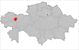
| 描述 | Map of the rayons of Kazakhstan. Created by Rarelibra 16:49, 3 August 2007 (UTC) for public domain use, using MapInfo Professional v8.5 and various mapping resources. |
| 日期 | (UTC) |
| 來源 | |
| 作者 |
|
| 這是一張修飾過的圖片,即本圖片是用軟體修改過後的版本。原版圖片來源:Kazakhstan rayons.png。
|
我,本作品的著作權持有者,決定用以下授權條款發佈本作品:
| 我,此作品的版權所有人,釋出此作品至公共領域。此授權條款在全世界均適用。 這可能在某些國家不合法,如果是的話: 我授予任何人有權利使用此作品於任何用途,除受法律約束外,不受任何限制。 |
原始上傳日誌
This image is a derivative work of the following images:
- File:Kazakhstan_rayons.png licensed with PD-self
- 2007-08-03T16:49:43Z Rarelibra 1601x1025 (56761 Bytes) Map of the rayons of Kazakhstan. Created by ~~~~ for public domain use, using MapInfo Professional v8.5 and various mapping resources.
Uploaded with derivativeFX
檔案歷史
點選日期/時間以檢視該時間的檔案版本。
| 日期/時間 | 縮圖 | 尺寸 | 用戶 | 備註 | |
|---|---|---|---|---|---|
| 目前 | 2011年9月2日 (五) 04:15 | | 1,601 × 1,025(93 KB) | Sibom | almaty |
| 2011年9月1日 (四) 16:41 |  | 1,601 × 1,025(94 KB) | Sibom | up | |
| 2009年7月18日 (六) 13:49 |  | 1,601 × 1,025(54 KB) | Vipera | {{Information |Description=Map of the rayons of Kazakhstan. Created by Rarelibra 16:49, 3 August 2007 (UTC) for public domain use, using MapInfo Professional v8.5 and various mapping resources. |Source=*File:Kazakhstan_rayons.png |
檔案用途
下列頁面有用到此檔案:
全域檔案使用狀況
以下其他 wiki 使用了這個檔案:
- bg.wikipedia.org 的使用狀況
- el.wikipedia.org 的使用狀況
- en.wikipedia.org 的使用狀況
- fa.wikipedia.org 的使用狀況
- fr.wikipedia.org 的使用狀況
- it.wikipedia.org 的使用狀況
- kk.wikipedia.org 的使用狀況
- ru.wikipedia.org 的使用狀況
- uk.wikipedia.org 的使用狀況
- uz.wikipedia.org 的使用狀況
- www.wikidata.org 的使用狀況