
File:Trnava Region - physical map.png

預覽大小:425 × 599 像素。 其他解析度:170 × 240 像素 | 340 × 480 像素 | 880 × 1,240 像素。
原始檔案 (880 × 1,240 像素,檔案大小:684 KB,MIME 類型:image/png)
| 描述 |
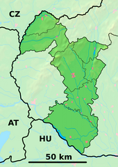
Background map of the Trnava Region, Slovakia, ready for the Geobox template, calibrated at en:Template:Geobox locator Trnava Region Outline map of the Trnava Region, Slovakia, ready for the Geobox template, calibrated at en:Template:Geobox locator Trnava Region |
| 日期 | (UTC) |
| 來源 | |
| 作者 |
|
| 這是一張修飾過的圖片,即本圖片是用軟體修改過後的版本,修改的方式或內容有:fusion。原版圖片來源:Trnava Region - outline map.svg。修改者:Adehertogh。
|
此檔案採用共享創意 姓名標示-相同方式分享 3.0 未在地化版本授權條款。
- 您可以自由:
- 分享 – 複製、發佈和傳播本作品
- 重新修改 – 創作演繹作品
- 惟需遵照下列條件:
- 姓名標示 – 您必須指名出正確的製作者,和提供授權條款的連結,以及表示是否有對內容上做出變更。您可以用任何合理的方式來行動,但不得以任何方式表明授權條款是對您許可或是由您所使用。
- 相同方式分享 – 如果您利用本素材進行再混合、轉換或創作,您必須基於如同原先的相同或兼容的條款,來分布您的貢獻成品。
原始上傳日誌
This image is a derivative work of the following images:
- File:Trnava_Region_-_background_map.png licensed with PD-Demis
- 2007-10-27T20:31:17Z Caroig 880x1240 (916063 Bytes)
- 2007-10-27T20:25:24Z Caroig 880x1240 (919490 Bytes) fixed alignment
- 2007-10-27T19:52:08Z Caroig 880x1240 (919490 Bytes) == Summary == {{Information |Description=Background map of the Trnava Region, Slovakia, ready for the [[:en:Template:Geobox|Geobox]] template, calibrated at [[:en:Template:Geobox locator Trnava Region]] |Source=Made my myself
- File:Trnava_Region_-_outline_map.svg licensed with Cc-by-sa-3.0,2.5,2.0,1.0, GFDL
- 2007-10-27T19:50:33Z Caroig 1100x1550 (122371 Bytes) == Summary == {{Information |Description=Outline map of the Trnava Region, Slovakia, ready for the [[:en:Template:Geobox|Geobox]] template, calibrated at [[:en:Template:Geobox locator Trnava Region]] |Source=self-made |Date=2
Uploaded with derivativeFX
檔案歷史
點選日期/時間以檢視該時間的檔案版本。
| 日期/時間 | 縮圖 | 尺寸 | 用戶 | 備註 | |
|---|---|---|---|---|---|
| 目前 | 2014年5月25日 (日) 21:36 | | 880 × 1,240(684 KB) | Sudo77(new) | Reverted to version as of 21:28, 25 May 2014 |
| 2014年5月25日 (日) 21:35 |  | 880 × 1,240(684 KB) | Sudo77(new) | x | |
| 2014年5月25日 (日) 21:28 |  | 880 × 1,240(684 KB) | Sudo77(new) | Trnava Region only | |
| 2010年9月27日 (一) 16:25 |  | 880 × 1,240(3.13 MB) | Adehertogh | {{Information |Description=Background map of the Trnava Region, Slovakia, ready for the Geobox template, calibrated at en:Template:Geobox locator Trnava Region Outline map of the Trnava Region, Slovakia, ready for the [[:en:Te |
檔案用途
下列3個頁面有用到此檔案:
全域檔案使用狀況
以下其他 wiki 使用了這個檔案:
- bg.wikipedia.org 的使用狀況
- Галанта
- Бродске
- Търнава (Словакия)
- Шаблон:ПК Словакия Търнавски край
- Мостова
- Олдза
- Пиещяни
- Йелка
- Цифер
- Дунайска Стреда
- Водеради
- Серед
- Дехтице
- Смоленице
- Добра вода (Словакия)
- Скалица (Словакия)
- Холич
- Копчани
- Радошовце (окръг Скалица)
- Кути (окръг Сеница)
- Подбранч
- Яблоница
- Приетрж
- Сеница (Словакия)
- Хълбоке
- Градиште под Вратном
- Осуске
- Соботиште
- Приевали
- Долне Дубове
- Болераз
- Катловце
- Букова
- Биньовце
- Богдановце-над-Търнавоу
- Борова (Словакия)
- Брестовани
- Долне Орешани
- Горне Орешани
- Долна Крупа
- Завар
- Бели Костол
- Влъчковце
- Горна Крупа
- Дълга (Словакия)
- Кошолна
- Ружиндол
- Лошонец
- Шелпице
- Шпачинце
檢視此檔案的更多全域使用狀況。