
File:WKshatrapas.jpg
預覽大小:467 × 600 像素。 其他解析度:187 × 240 像素 | 374 × 480 像素 | 598 × 768 像素 | 1,121 × 1,440 像素。
原始檔案 (1,121 × 1,440 像素,檔案大小:309 KB,MIME 類型:image/jpeg)
摘要
| 描述 |
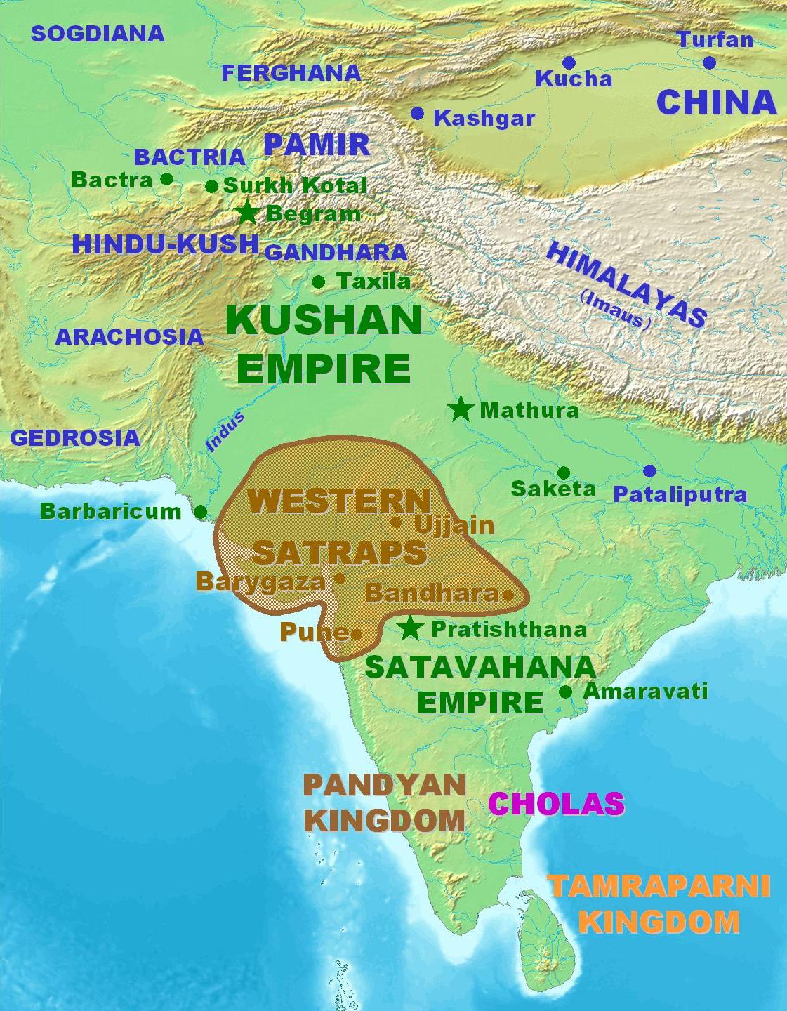
English: Territorial extent of the Western Kshatrapas. |
||
| 來源 |
|
||
| 作者 | User PHG at en.wikipedia.org | ||
| 授權許可 (重用此檔案) |
Personal map. Released in the Public Domain. |

授權條款
| 此作品已由其作者,PHG,釋出至公有領域。此授權條款在全世界均適用。 這可能在某些國家不合法,如果是的話: |
檔案歷史
點選日期/時間以檢視該時間的檔案版本。
| 日期/時間 | 縮圖 | 尺寸 | 用戶 | 備註 | |
|---|---|---|---|---|---|
| 目前 | 2007年3月4日 (日) 11:33 | | 1,121 × 1,440(309 KB) | World Imaging | Better map |
| 2007年2月5日 (一) 19:32 |  | 1,122 × 1,440(313 KB) | World Imaging | Better image. | |
| 2007年2月4日 (日) 20:58 |  | 1,127 × 1,440(316 KB) | World Imaging | Better map. | |
| 2007年2月4日 (日) 15:28 |  | 1,124 × 1,440(315 KB) | World Imaging | Better map. Own work. | |
| 2006年12月13日 (三) 23:25 |  | 462 × 504(37 KB) | Electionworld | {{ew|en|PHG}} Territorial extent of the Western Kshatrapas. Personal map. Released in the Public Domain. {{pd-user|PHG}} |
檔案用途
下列頁面有用到此檔案:
全域檔案使用狀況
以下其他 wiki 使用了這個檔案:
- azb.wikipedia.org 的使用狀況
- ba.wikipedia.org 的使用狀況
- bn.wikipedia.org 的使用狀況
- cs.wikipedia.org 的使用狀況
- en.wikipedia.org 的使用狀況
- es.wikipedia.org 的使用狀況
- fa.wikipedia.org 的使用狀況
- fa.wikibooks.org 的使用狀況
- fr.wikipedia.org 的使用狀況
- hi.wikipedia.org 的使用狀況
- hu.wikipedia.org 的使用狀況
- hy.wikipedia.org 的使用狀況
- it.wikipedia.org 的使用狀況
- ja.wikipedia.org 的使用狀況
- ka.wikipedia.org 的使用狀況
- lt.wikipedia.org 的使用狀況
- ml.wikipedia.org 的使用狀況
- nl.wikipedia.org 的使用狀況
- ru.wikipedia.org 的使用狀況
- sh.wikipedia.org 的使用狀況
- sq.wikipedia.org 的使用狀況
- ta.wikipedia.org 的使用狀況
- tt.wikipedia.org 的使用狀況
- uk.wikipedia.org 的使用狀況
- vi.wikipedia.org 的使用狀況
- www.wikidata.org 的使用狀況