
File:Wfm cape breton island pseudocolour.jpg

預覽大小:800 × 593 像素。 其他解析度:320 × 237 像素 | 640 × 474 像素 | 1,024 × 758 像素 | 1,280 × 948 像素。
原始檔案 (1,280 × 948 像素,檔案大小:130 KB,MIME 類型:image/jpeg)
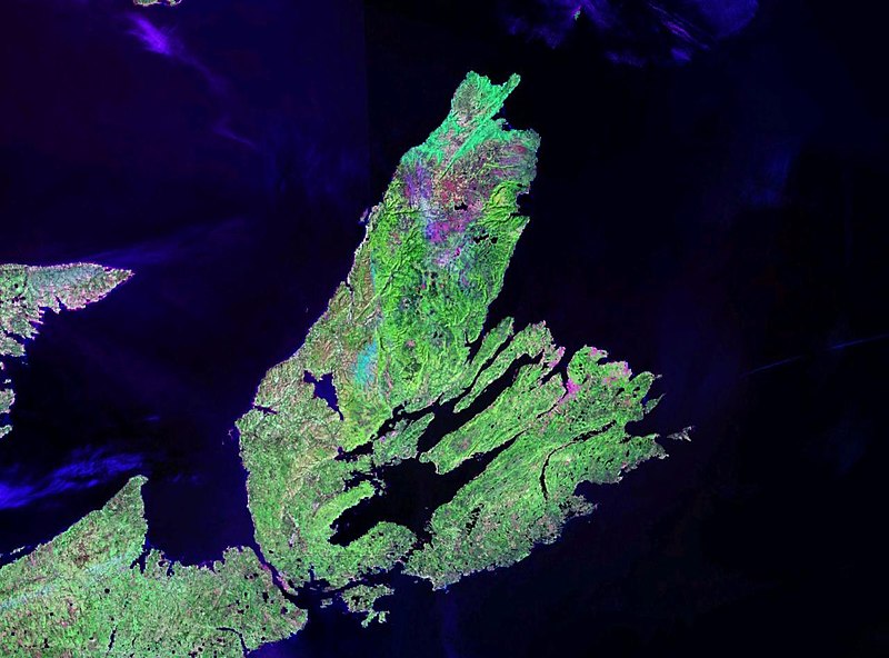
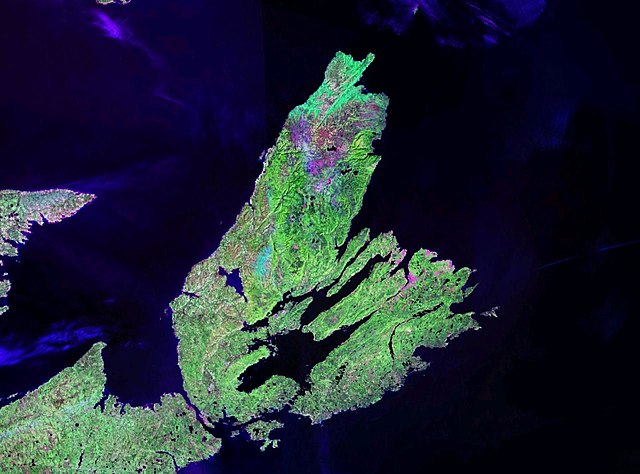
| 描述 | Cape Breton Island |
| 日期 | 日期不明 |
| 來源 | NASA Landsat |
| 作者 | NASA |
| 授權許可 (重用此檔案) |
usgov-PD |
| 本圖像屬於公有領域,因其為NASA的World Wind衛星地圖瀏覽器的一張截圖,且使用了公有領域圖層,如Blue Marble、MODIS、Landsat、SRTM、USGS、GLOBE等。
|
 |
檔案歷史
點選日期/時間以檢視該時間的檔案版本。
| 日期/時間 | 縮圖 | 尺寸 | 用戶 | 備註 | |
|---|---|---|---|---|---|
| 目前 | 2006年4月28日 (五) 21:09 | | 1,280 × 948(130 KB) | Finlay McWalter | {{Information| |Description=Cape Breton Island |Source=NASA Landsat |Date=? |Author=NASA |Permission=usgov-PD |other_versions= }} {{PD-WorldWind}} Category:Satellite images of islands Category:Satellite pictures of Canada |
檔案用途
下列頁面有用到此檔案:
全域檔案使用狀況
以下其他 wiki 使用了這個檔案:
- af.wikipedia.org 的使用狀況
- ang.wikipedia.org 的使用狀況
- ar.wikipedia.org 的使用狀況
- arz.wikipedia.org 的使用狀況
- bg.wikipedia.org 的使用狀況
- ca.wikipedia.org 的使用狀況
- el.wikipedia.org 的使用狀況
- en.wikipedia.org 的使用狀況
- eo.wikipedia.org 的使用狀況
- es.wikipedia.org 的使用狀況
- et.wikipedia.org 的使用狀況
- fr.wikipedia.org 的使用狀況
- gl.wikipedia.org 的使用狀況
- gv.wikipedia.org 的使用狀況
- hr.wikipedia.org 的使用狀況
- it.wikipedia.org 的使用狀況
- ka.wikipedia.org 的使用狀況
- ko.wikipedia.org 的使用狀況
- la.wikipedia.org 的使用狀況
- nl.wikipedia.org 的使用狀況
- nn.wikipedia.org 的使用狀況
- no.wikipedia.org 的使用狀況
- pl.wikipedia.org 的使用狀況
- pl.wiktionary.org 的使用狀況
- sh.wikipedia.org 的使用狀況
- sl.wikipedia.org 的使用狀況
- uk.wikipedia.org 的使用狀況
- uz.wikipedia.org 的使用狀況
- vi.wikipedia.org 的使用狀況
- war.wikipedia.org 的使用狀況
- www.wikidata.org 的使用狀況