
File:Whangarei Territorial Authority.PNG
此為最大尺寸。
Whangarei_Territorial_Authority.PNG (246 × 352 像素,檔案大小:7 KB,MIME 類型:image/png)
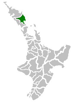
(Location map of the Whangarei Territorial Authority, New Zealand)
| |
此作品已由其作者,中文維基百科專案的Tom the Boffin,釋出至公有領域。此授權條款在全世界均適用。 如果法律不適用時: |
Uploaded to Commons by user:PerPlex:
檔案歷史
點選日期/時間以檢視該時間的檔案版本。
| 日期/時間 | 縮圖 | 尺寸 | 用戶 | 備註 | |
|---|---|---|---|---|---|
| 目前 | 2007年7月1日 (日) 16:38 | | 246 × 352(7 KB) | PerPlex | (Location map of the Hokianga Harbour, New Zealand) {{PD-user-w|en|English Wikipedia|Tom the Boffin}} Uploaded to Commons by user:PerPlex: Category:New Zealand Category:Maps of New Zealand |
檔案用途
下列頁面有用到此檔案:
全域檔案使用狀況
以下其他 wiki 使用了這個檔案:
- ca.wikipedia.org 的使用狀況
- it.wikipedia.org 的使用狀況
- ms.wikipedia.org 的使用狀況
- nn.wikipedia.org 的使用狀況
- pnb.wikipedia.org 的使用狀況
- sv.wikipedia.org 的使用狀況
- www.wikidata.org 的使用狀況