
File:1698PhilipLeaPANJmap.jpg
此為最大尺寸。
1698PhilipLeaPANJmap.jpg (723 × 600 像素,檔案大小:282 KB,MIME 類型:image/jpeg)
摘要
| 描述 |
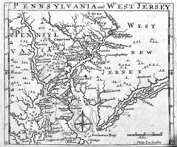
English: Map of Pennsylvania and "West New Jersey" published in 1698 by Philip Lea in London. |
| 日期 | |
| 來源 |
Transferred from en.wikipedia to Commons by Sreejithk2000 using CommonsHelper. |
| 作者 | Philip Lea |
授權條款
|
本作品在其來源國以及其他版權期限是作者逝世後100年或以下的國家與地區屬於公有領域。 | |
| 此作品無已知的著作權限制,亦不受所有相關和鄰接的權利限制。 | |
原始上傳日誌
The original description page was here. All following user names refer to en.wikipedia.
- 2007-12-02 16:11 Smallbones 723×600× (288353 bytes) Map of Pennsylvania and "West New Jersey" published in 1698 by Philp Lea in London. From Princeton Library website
檔案歷史
點選日期/時間以檢視該時間的檔案版本。
| 日期/時間 | 縮圖 | 尺寸 | 用戶 | 備註 | |
|---|---|---|---|---|---|
| 目前 | 2010年5月28日 (五) 06:06 | | 723 × 600(282 KB) | File Upload Bot (Magnus Manske) | {{BotMoveToCommons|en.wikipedia|year={{subst:CURRENTYEAR}}|month={{subst:CURRENTMONTHNAME}}|day={{subst:CURRENTDAY}}}} {{Information |Description={{en|Map of Pennsylvania and "West New Jersey" published in 1698 by Philp Lea in London.}} |Source=Transferr |
檔案用途
下列頁面有用到此檔案:
全域檔案使用狀況
以下其他 wiki 使用了這個檔案:
- azb.wikipedia.org 的使用狀況
- en.wikipedia.org 的使用狀況
- hu.wikipedia.org 的使用狀況
- no.wikipedia.org 的使用狀況