
File:1780 map of Charleston, South Carolina.jpeg
預覽大小:445 × 599 像素。 其他解析度:178 × 240 像素 | 356 × 480 像素 | 570 × 768 像素 | 760 × 1,024 像素 | 1,985 × 2,673 像素。
原始檔案 (1,985 × 2,673 像素,檔案大小:1.07 MB,MIME 類型:image/jpeg)
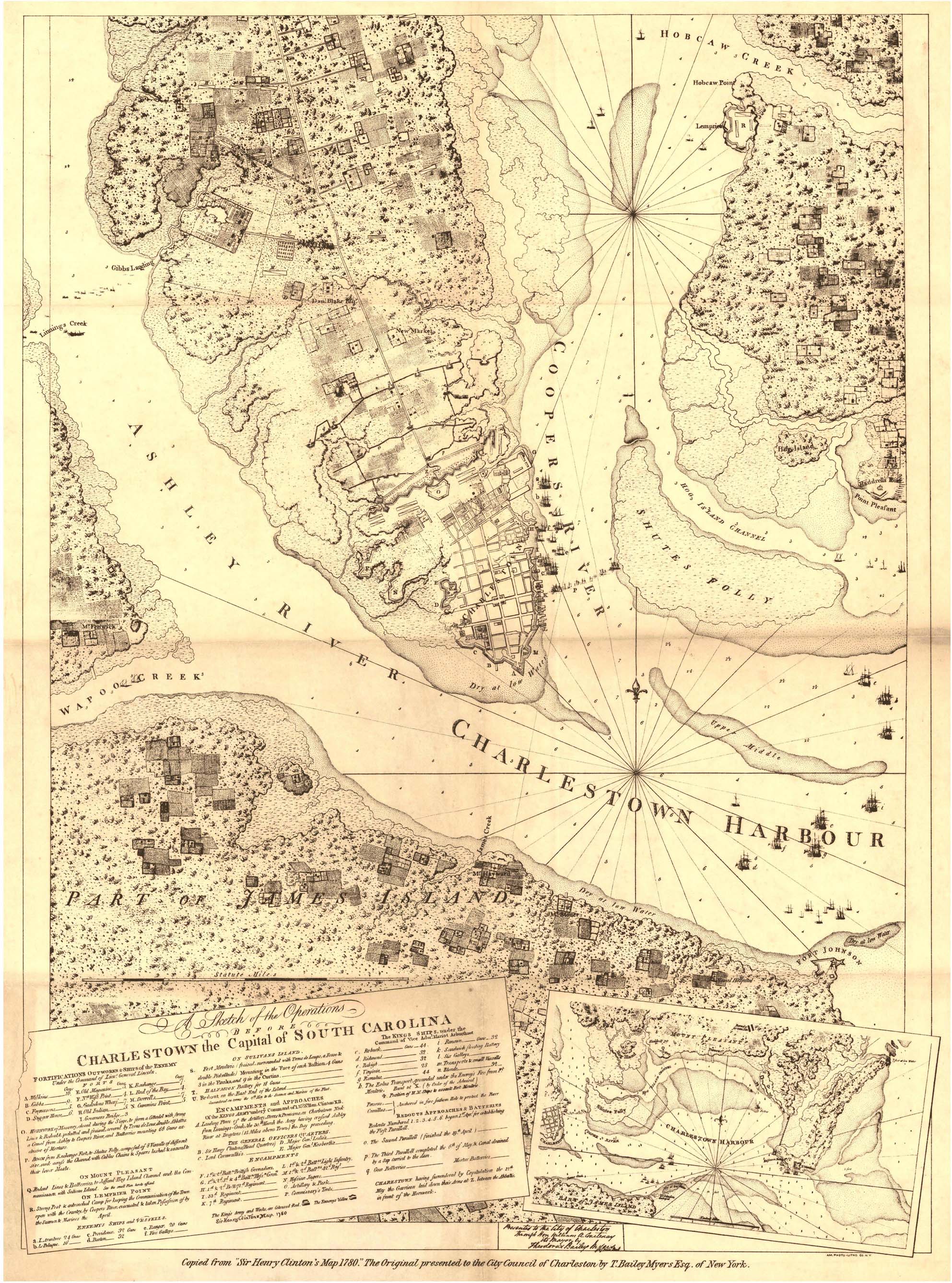
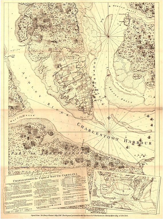
| 描述 | "A sketch of the operations before Charlestown, the capital of South Carolina" | ||||
| 日期 | |||||
| 來源 | Historical Maps of Alabama collection, University of Alabama Department of Geography | ||||
| 作者 | Sir Henry Clinton | ||||
| 授權許可 (重用此檔案) |
|
||||
檔案歷史
點選日期/時間以檢視該時間的檔案版本。
| 日期/時間 | 縮圖 | 尺寸 | 用戶 | 備註 | |
|---|---|---|---|---|---|
| 目前 | 2009年12月17日 (四) 23:31 | | 1,985 × 2,673(1.07 MB) | Spyder Monkey | {{Information |Description="A sketch of the operations before Charlestown, the capital of South Carolina" |Source=[http://alabamamaps.ua.edu/historicalmaps/us_states/southcarolina/index.html Historical Maps of Alabama collection], University of Alabama De |
檔案用途
下列頁面有用到此檔案:
全域檔案使用狀況
以下其他 wiki 使用了這個檔案:
- en.wikipedia.org 的使用狀況
- fr.wikipedia.org 的使用狀況