
File:Aisne department location map.svg

此 SVG 檔案的 PNG 預覽的大小:404 × 599 像素。 其他解析度:162 × 240 像素 | 323 × 480 像素 | 518 × 768 像素 | 690 × 1,024 像素 | 1,381 × 2,048 像素 | 1,124 × 1,667 像素。
原始檔案 (SVG 檔案,表面大小:1,124 × 1,667 像素,檔案大小:399 KB)
摘要
| 拍攝地點 | | 位於此地的本圖片與其他圖片: OpenStreetMap |
|---|
| 描述 |
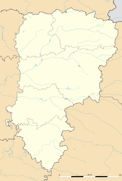
English: Blank administrative map of the department of Aisne, France, as in January 2015, for geo-location purpose, with distinct boundaries for regions, departments and arrondissements.
Français : Carte administrative vierge du département de l'Aisne, France, tel qu'en janvier 2015, destinée à la géolocalisation, avec limite distincte des régions, départements et arrondissements. Estimated scale: 1:360,000 (precision: 90 m)
Geographic limits of the map:
|
||
| 日期 | |||
| 來源 |
自己的作品
|
||
| 作者 | Eric Gaba (Sting - fr:Sting) | ||
| 授權許可 (重用此檔案) |
|
||
| 其他版本 |
|

授權條款
Eric Gaba, Wikimedia Commons user Sting,此作品的版權所有人,決定用以下授權條款發佈本作品:
此檔案採用共享創意 姓名標示-相同方式分享 3.0 未在地化版本授權條款。
姓名標示: Eric Gaba, Wikimedia Commons user Sting
- 您可以自由:
- 分享 – 複製、發佈和傳播本作品
- 重新修改 – 創作演繹作品
- 惟需遵照下列條件:
- 姓名標示 – 您必須指名出正確的製作者,和提供授權條款的連結,以及表示是否有對內容上做出變更。您可以用任何合理的方式來行動,但不得以任何方式表明授權條款是對您許可或是由您所使用。
- 相同方式分享 – 如果您利用本素材進行再混合、轉換或創作,您必須基於如同原先的相同或兼容的條款,來分布您的貢獻成品。
檔案歷史
點選日期/時間以檢視該時間的檔案版本。
| 日期/時間 | 縮圖 | 尺寸 | 用戶 | 備註 | |
|---|---|---|---|---|---|
| 目前 | 2015年1月12日 (一) 17:05 | | 1,124 × 1,667(399 KB) | Sting | == {{int:filedesc}} == {{Location|49|27|00|N|03|36|00|E|scale:500000}} {{Information |Description={{en|Blank administrative map of the department of Aisne, France, as in January 2015, for geo-location purpose, with distinct boundaries for... |
檔案用途
超過 100 個頁面有用到此檔案。 下列清單只列出前 100 筆有用到此檔案的頁面。 您也可以檢視完整清單。
- 乌尔克河畔比利
- 乌尔克河畔阿尔芒蒂耶尔
- 伯奈 (埃纳省)
- 伯尼厄
- 伯瓦尔德
- 博内伊
- 博安昂韦尔芒多瓦
- 博尔瓦尔
- 博尼
- 博托尔
- 博梅
- 博瓦韦尔芒杜瓦
- 博蒙昂贝讷
- 博讷瓦兰
- 博里约
- 吉斯
- 埃纳河畔比利
- 塞尔河畔博蒙
- 塞尔河畔巴朗通
- 塞尔河畔阿西斯
- 巴朗通塞勒
- 巴朗通比尼
- 巴涅 (埃纳省)
- 巴索勒欧莱尔
- 巴里西
- 布埃
- 布孔维尔-沃克莱尔
- 布朗济莱菲姆
- 布瓦莱帕尔尼
- 布莱姆 (埃纳省)
- 布莱朗库尔
- 布里地区博尔讷
- 拉昂地区欧比尼
- 昂吉尔库尔勒萨尔
- 昂布列夫
- 昂布勒尼
- 昂德兰
- 昂西安维尔
- 桑布尔河畔贝尔格
- 欧努瓦苏拉昂
- 欧日 (埃纳省)
- 欧比尼欧凯讷
- 欧特勒维尔
- 欧特勒芒库尔
- 欧特雷普
- 欧迪尼 (埃纳省)
- 欧迪尼库尔
- 欧邦舍勒欧布瓦
- 欧邦通
- 比尚库尔
- 比约克西
- 比耶夫尔 (埃纳省)
- 绍尼
- 艾松维尔-贝诺维尔
- 艾泽勒
- 艾济-茹伊
- 蒂耶拉什地区巴尔济
- 贝利库尔
- 贝勒 (埃纳省)
- 贝唐库尔昂沃
- 贝基尼
- 贝尔利斯
- 贝尔尼里维耶尔
- 贝尔朗库尔 (埃纳省)
- 贝尔济勒塞克
- 贝尔诺
- 贝尼和卢瓦济
- 贝托库尔-埃普尔通
- 贝斯蒙
- 贝朗格利斯
- 贝梅
- 贝洛 (埃纳省)
- 贝特尼库尔
- 贝特里库尔
- 贝聚勒盖里
- 贝聚圣日耳曼
- 贝里欧巴克
- 贝里约
- 邦库尔 (埃纳省)
- 邦西尼
- 阿什里
- 阿兰库尔 (埃纳省)
- 阿努瓦
- 阿勒芒 (埃纳省)
- 阿吉尔库尔
- 阿尔唐普
- 阿尔西圣雷斯蒂蒂
- 阿尔通日
- 阿尔雄
- 阿尼库尔和塞谢勒
- 阿尼济堡
- 阿尼马丹略
- 阿朗西
- 阿米尼鲁伊
- 阿米方丹
- 阿蒂伊
- 阿蒂苏拉昂
- 阿西 (埃纳省)
- 阿贝库尔
- 韦勒河畔巴佐什
檢視連結到這個檔案的更多連結。
全域檔案使用狀況
以下其他 wiki 使用了這個檔案:
- als.wikipedia.org 的使用狀況
- de.wikipedia.org 的使用狀況
- en.wikipedia.org 的使用狀況
- eo.wikipedia.org 的使用狀況
- Villers-Cotterêts
- Vermand
- Château-Thierry
- Laon
- Saint-Quentin (Aisne)
- Soissons
- Vervins
- Beaurevoir
- Marly-Gomont
- Chézy-sur-Marne
- La Ferté-Milon
- Nogent-l'Artaud
- Charly-sur-Marne
- Bazoches-sur-Vesles
- Tergnier
- Ŝablono:Situo sur mapo Francio Aisne
- Saint-Quentin (stacidomo)
- Quierzy
- Laon (stacidomo)
- Soissons (stacidomo)
- Hirson (stacidomo)
- Hirson
- Vervins (stacidomo)
- Villers-Cotterêts (stacidomo)
- Longpont (stacidomo)
- Longpont
- Hirson-Écoles (stacidomo)
- Vierzy (stacidomo)
- Vierzy
- Versigny (stacidomo)
- Versigny (Aisne)
- Vaumoise (stacidomo)
- Coyolles
- Vauxaillon (stacidomo)
- Vauxaillon
- Verneuil-sur-Serre (stacidomo)
- Verneuil-sur-Serre
- Viry-Noureuil (stacidomo)
- Viry-Noureuil
- Fère-en-Tardenois (stacidomo)
- Fère-en-Tardenois
檢視此檔案的更多全域使用狀況。