
File:Blake 2020-01-06 0537Z.jpg

預覽大小:450 × 600 像素。 其他解析度:180 × 240 像素 | 360 × 480 像素 | 576 × 768 像素 | 768 × 1,024 像素 | 1,536 × 2,048 像素 | 3,519 × 4,692 像素。
原始檔案 (3,519 × 4,692 像素,檔案大小:2.96 MB,MIME 類型:image/jpeg)
摘要
| 描述 |
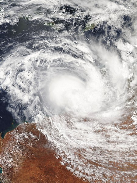
English: Tropical Cyclone Blake at peak intensity on 6 January 2020, just off the coast of Western Australia's Dampier Peninsula. The system is at Category 1 intensity on the Australian scale, with 10-minute sustained winds of 75 km/h (45 mph). |
| 日期 | |
| 來源 | NASA Worldview |
| 作者 | National Aeronautics and Space Administration (NASA) - 'Aqua' satellite |
| 拍攝地點 | | 位於此地的本圖片與其他圖片: OpenStreetMap |
|---|
授權條款
| 本作品由NASA創作,屬於公有領域。根據NASA的版權政策:“NASA的創作除非另有聲明否則不受版權保護。”(參見:Template:PD-USGov/zh,NASA版權政策或JPL圖像使用政策) | ||
 |
警告:
|
檔案歷史
點選日期/時間以檢視該時間的檔案版本。
| 日期/時間 | 縮圖 | 尺寸 | 用戶 | 備註 | |
|---|---|---|---|---|---|
| 目前 | 2020年1月6日 (一) 07:47 | | 3,519 × 4,692(2.96 MB) | ChocolateTrain | User created page with UploadWizard |
檔案用途
下列頁面有用到此檔案:
全域檔案使用狀況
以下其他 wiki 使用了這個檔案:
- de.wikipedia.org 的使用狀況
- en.wikipedia.org 的使用狀況
- ko.wikipedia.org 的使用狀況
- th.wikipedia.org 的使用狀況
- vi.wikipedia.org 的使用狀況