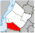
File:Brossard Quebec location diagram.PNG
外觀
Brossard_Quebec_location_diagram.PNG (329 × 315 像素,檔案大小:36 KB,MIME 類型:image/png)
檔案歷史
點選日期/時間以檢視該時間的檔案版本。
| 日期/時間 | 縮圖 | 尺寸 | 用戶 | 備註 | |
|---|---|---|---|---|---|
| 目前 | 2023年7月4日 (二) 16:58 |  | 329 × 315(36 KB) | Roncanada | Correction to Longueuil's border |
| 2009年4月27日 (一) 00:59 |  | 325 × 315(37 KB) | Gordalmighty | map outline correction | |
| 2009年4月25日 (六) 03:17 |  | 325 × 315(38 KB) | Gordalmighty | {{Information |Description={{en|1=Location of Brossard, Quebec within the Urban Agglomeration of Longueuil.}} |Source=Own work by uploader |Author=Gordalmighty |Date=2009-04-24 |Permission= |other_versions= }} <!--{{ImageUpload|full |
檔案用途
下列頁面有用到此檔案:
全域檔案使用狀況
以下其他 wiki 使用了這個檔案:
- ar.wikipedia.org 的使用狀況
- de.wikipedia.org 的使用狀況
- diq.wikipedia.org 的使用狀況
- en.wikipedia.org 的使用狀況
- eo.wikipedia.org 的使用狀況
- es.wikipedia.org 的使用狀況
- fa.wikipedia.org 的使用狀況
- fr.wikipedia.org 的使用狀況
- fr.wikinews.org 的使用狀況
- hak.wikipedia.org 的使用狀況
- ja.wikipedia.org 的使用狀況
- ko.wikipedia.org 的使用狀況
- vo.wikipedia.org 的使用狀況
- www.wikidata.org 的使用狀況

